
Visualizations (Web Applications) 📍
What are the GIS Web Applications?
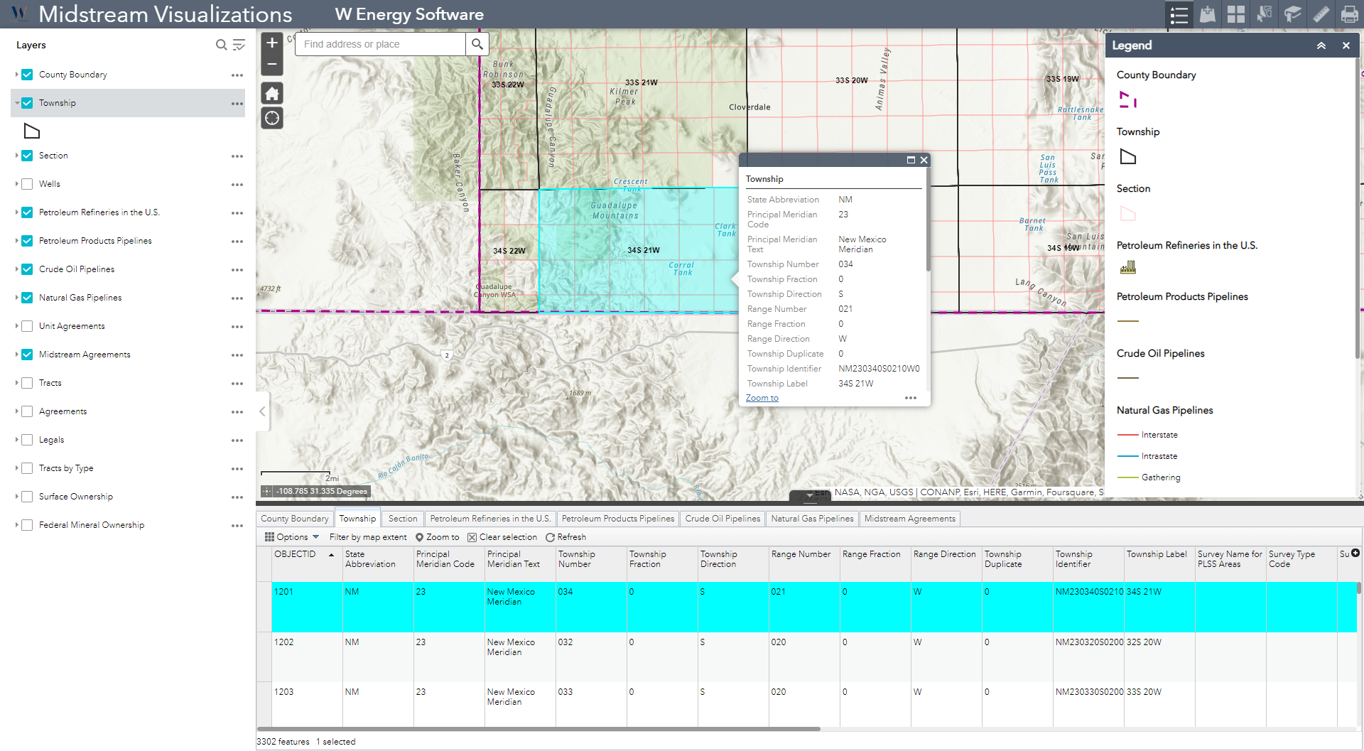
The GIS Visualizations, also known as the web applications, are read only, interactive displays of geographic information that the GIS Analysts publish to the cloud for non-GIS Analysts to use.
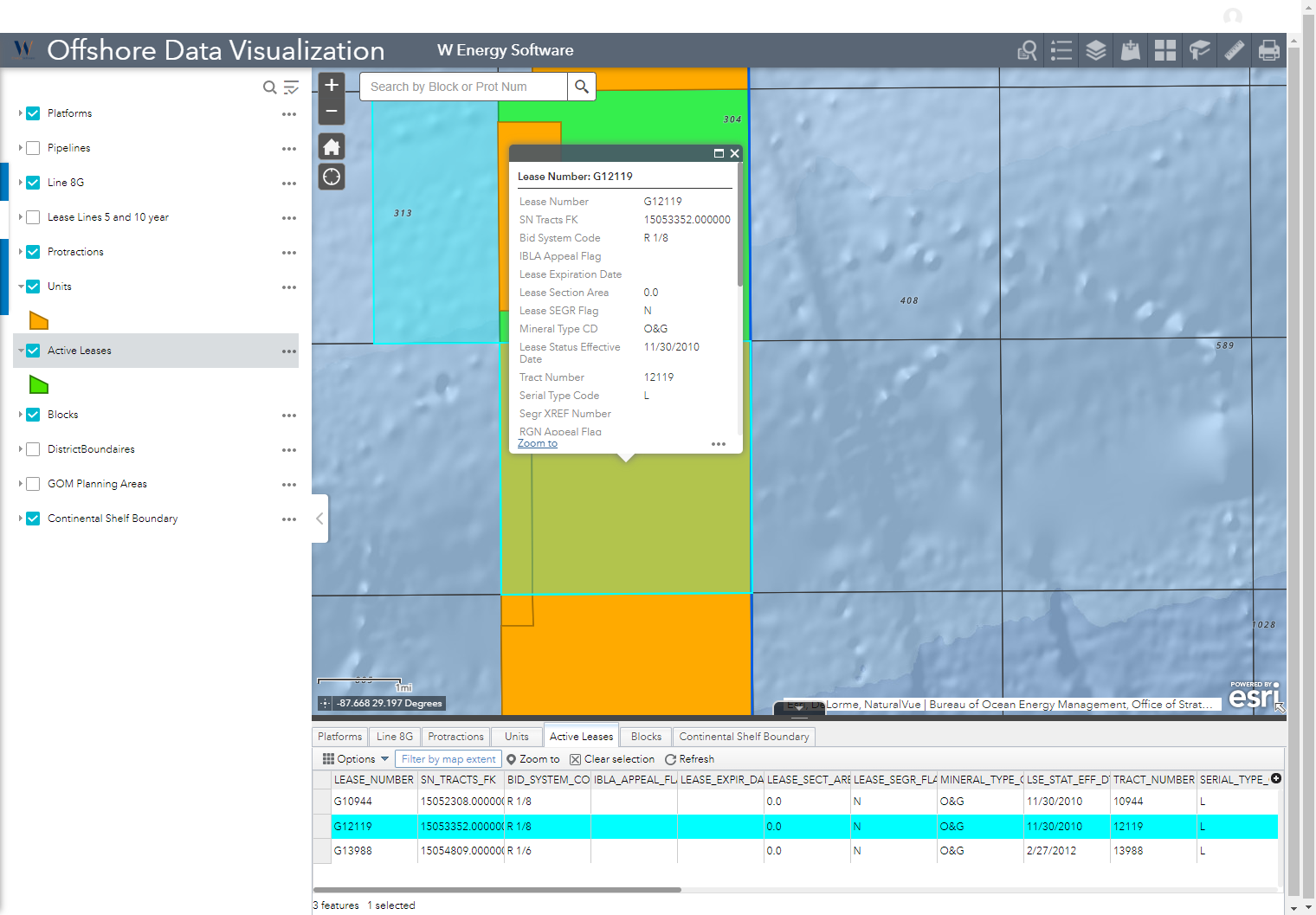
Why would a client use the Applications?
The web applications are available to clients that work outside of the GIS department. These apps are a solution to provide spatial information to clients without having each individual subscribe to a relatively expensive ArcGIS license.
These tools are more user-friendly to those not familiar with using native Esri tools (ArcMap, ArcGIS Pro). Aside from saving user-level bookmarks and annotations, the source data that was published is not altered in the web applications, thus there is no risk to corrupting data.
ArcGIS Online
ArcGIS Online (AGOL) is a web-based mapping software hosted by Esri to build and share web applications.
W Energy owns its own AGOL Organization through an annual subscription with Esri where we publish web maps and create corresponding web applications to complement them. Below are different methodologies on how we can deliver these web applications to clients.
Option #1: From the W Energy AGOL Organization, W publishes then shares the finished web applications to our client’s AGOL Organization.
Option #2: The web map and app are created in the client AGOL Organization.
ArcGIS Enterprise Portal
ArcGIS Enterprise Portal is another web-based mapping solution with similar capabilities as AGOL but this is hosted on a client infrastructure (i.e. on-premise server, cloud, virtual machine). This provides clients with complete control over the system for future patch and upgrade timings.
With Portal, clients can also connect to local user-managed data stores versus in AGOL, all data is hosted in the Esri cloud.
Option #3: The web map and app are created in the client Enterprise Portal.
AGOL vs Portal
Below are a list of the pros and cons to the 3 options listed in publishing the web applications.
Publish App to Client AGOL Organization | Pro | Con |
| More client flexibility and freedom to update map configurations (Ex. Map extent, layer information). | W Energy requires the client AGOL Org URL, and temporary admin credentials to the org. |
| Fewer firewalls for W Energy to pass through thus easier to interface with. | AGOL runs on Esri-admin cloud infrastructure. |
| Client published maps are available for download to ArcGIS Field maps mobile app for offline viewing. |
|
|
|
|
Publish App to W Energy AGOL Organization | Pro | Con |
(Map published to W Energy AGOL, client creates user group, adds W Energy to user group, invites W Energy to share the published web map, W Energy shares the web map with client AGOL Org). | W Energy responsible for maintaining web map and web application. | Less client flexibility and freedom to update map configurations (Ex. Map extent, layer information). |
| No firewalls for W Energy to work past. | AGOL runs on Esri-admin cloud infrastructure. |
| Client published maps are available for download to ArcGIS Field maps mobile app for offline viewing. |
|
|
|
|
Publish App to Client Portal | Pro | Con |
| More client flexibility and freedom to update map configurations (Ex. Map extent, layer information). | W Energy must work with client IT team to get past firewalls. |
| Client published maps are available for download to ArcGIS Field maps mobile app for offline viewing. | W Energy requires remote desktop access to the server with Portal installed, the Portal URL, and temporary admin credentials to the Portal. |
| Better if client requires full control over hardware running the portal to maintain a particular service level agreement (SLA). | Expensive to have Portal. |
| Better if client allows service publishing from website and client data is prohibited from being physically stored off-prem. | Components run on client hardware. |
| Works even if computers in org have unreliable/no internet connection. |
|
How to setup the Web Applications
The web applications are currently setup by our GIS Web Developer, Jeremy Larsen. Please reach out to Jeremy on setup. Below is a brief overview on what the web application consists of.
Compile the Layers that Will be Published
The layers that will be published to AGOL/Portal need to be compiled in some sort of fashion whether in an MXD, a series of shapefiles, feature layer, etc.
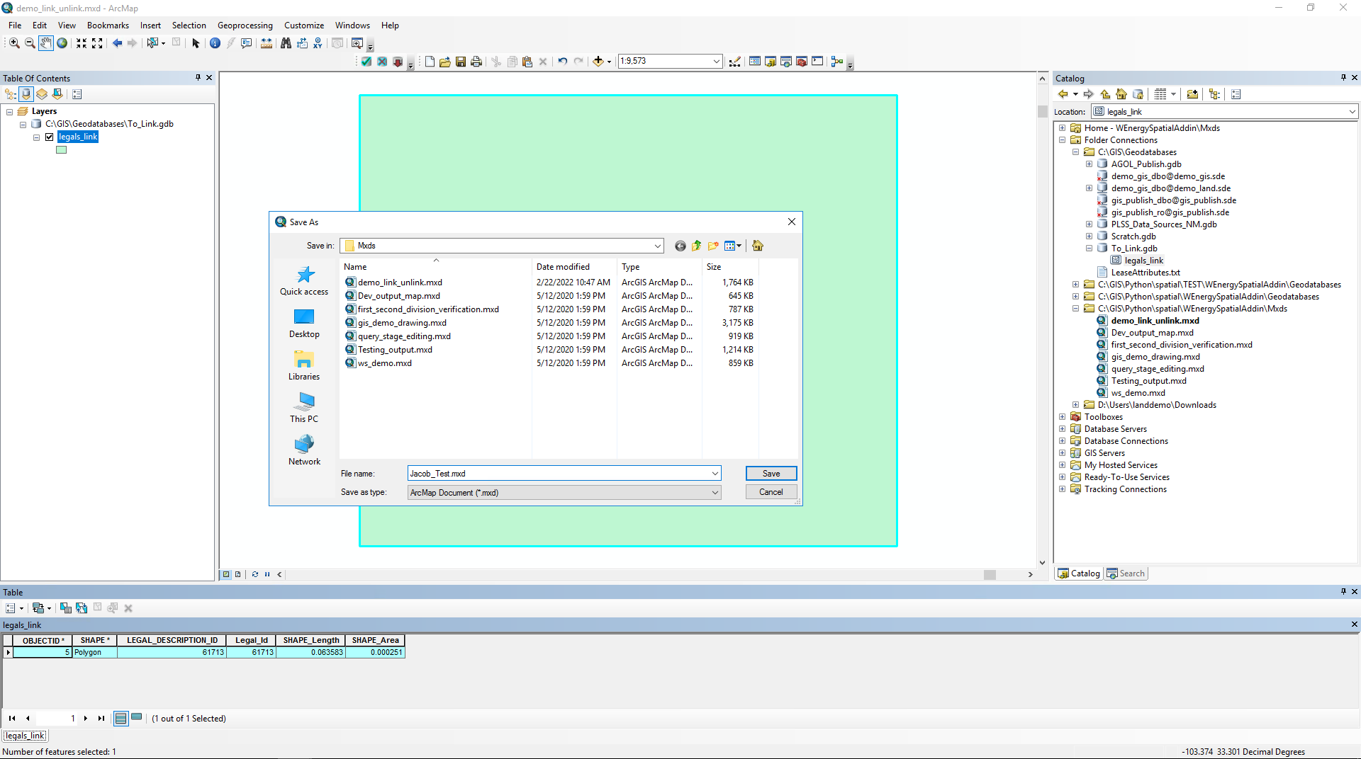
Set the Data Source
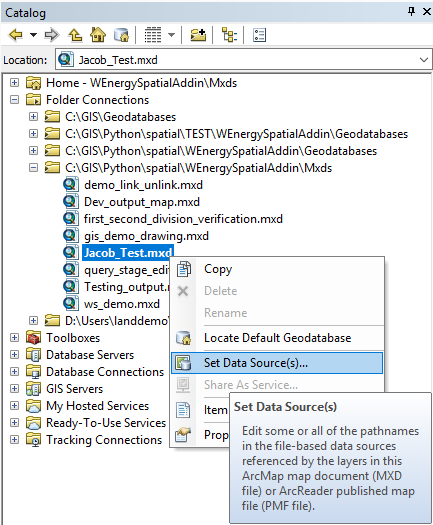
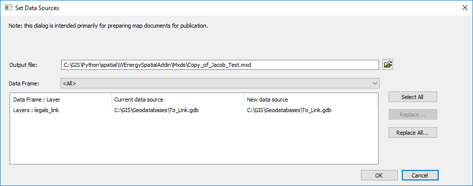
Ensure the location for the data sources for the layers in the MXD are accurate. If the MXD was just created with the layers added, this step should not be needed. If we are copying the layers from an MXD template, then the data sources will need to be updated for each client environment.
Connecting to an ArcGIS Server
The layers will need to be published to an ArcGIS Server, thus we will need to connect to it by inputting the credentials.
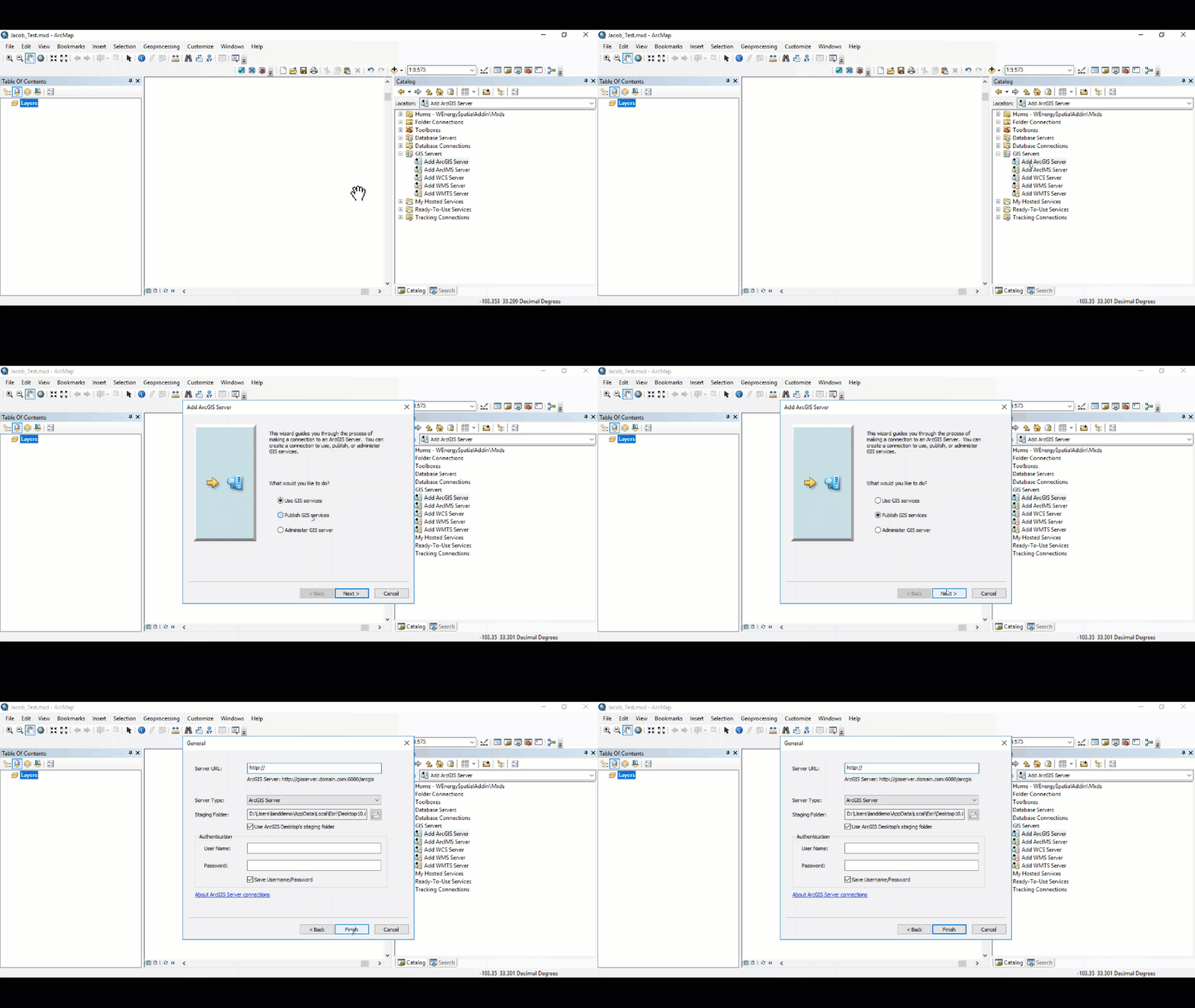
Register Database Connections
If these layers are live layers that are sourced from a database connection, the database connection needs to be registered. This can be done by right-clicking on the newly added GIS server and selecting Server Properties.
Toggle over to the Data Store tab. Click on the “+“ tab on the right to add a database connection.
Publishing the Layers to ArcGIS Server
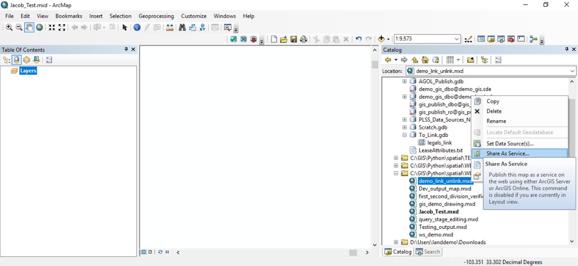
To publish the MXDs as a service, right-click on the MXD and select Share As Service…
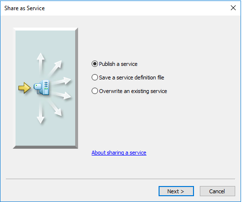
Select Publish a service.
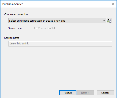
Select the ArcGIS Server that we previously connected to.
Once the service has been published, it will appear under the Catalog Pane / GIS Servers / ArcGIS Server directory. Right-click on the service and copy the service definition.
Adding the Service Definitions to a Web Map
Authenticate into the W Energy AGOL Organization and navigate to Map Viewer Classic:
https://wenergy.maps.arcgis.com/home/webmap/viewer.html
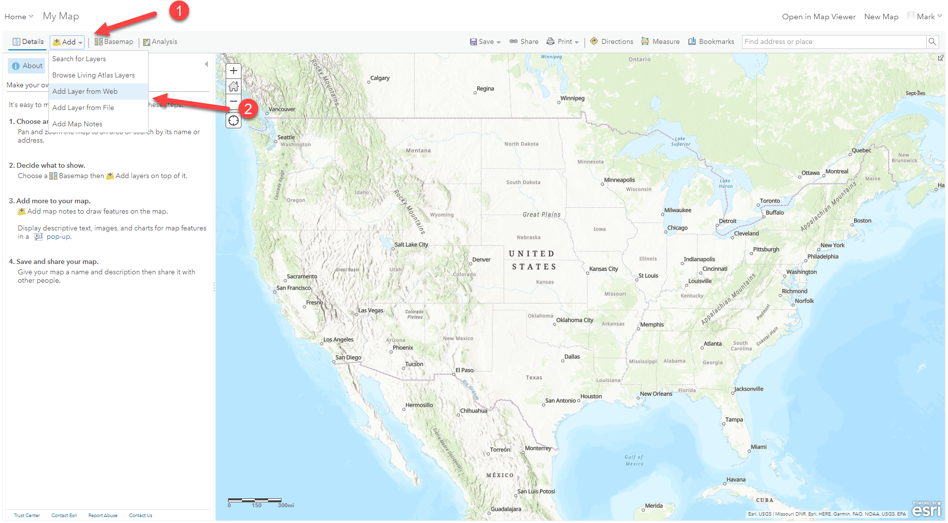
Select Add followed by Add Layer from Web.
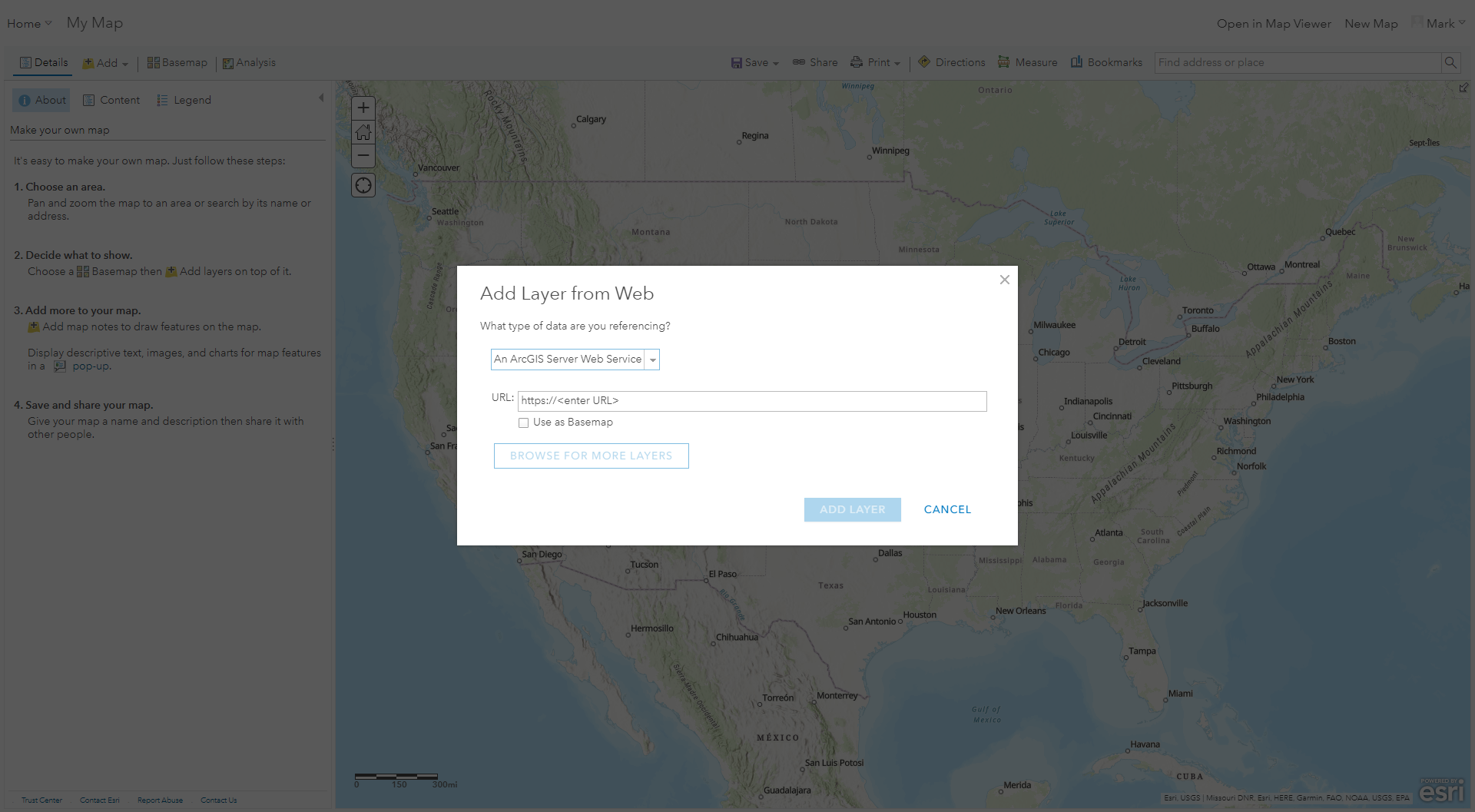
Paste your service definition here and select Add Layer. Save the web map.
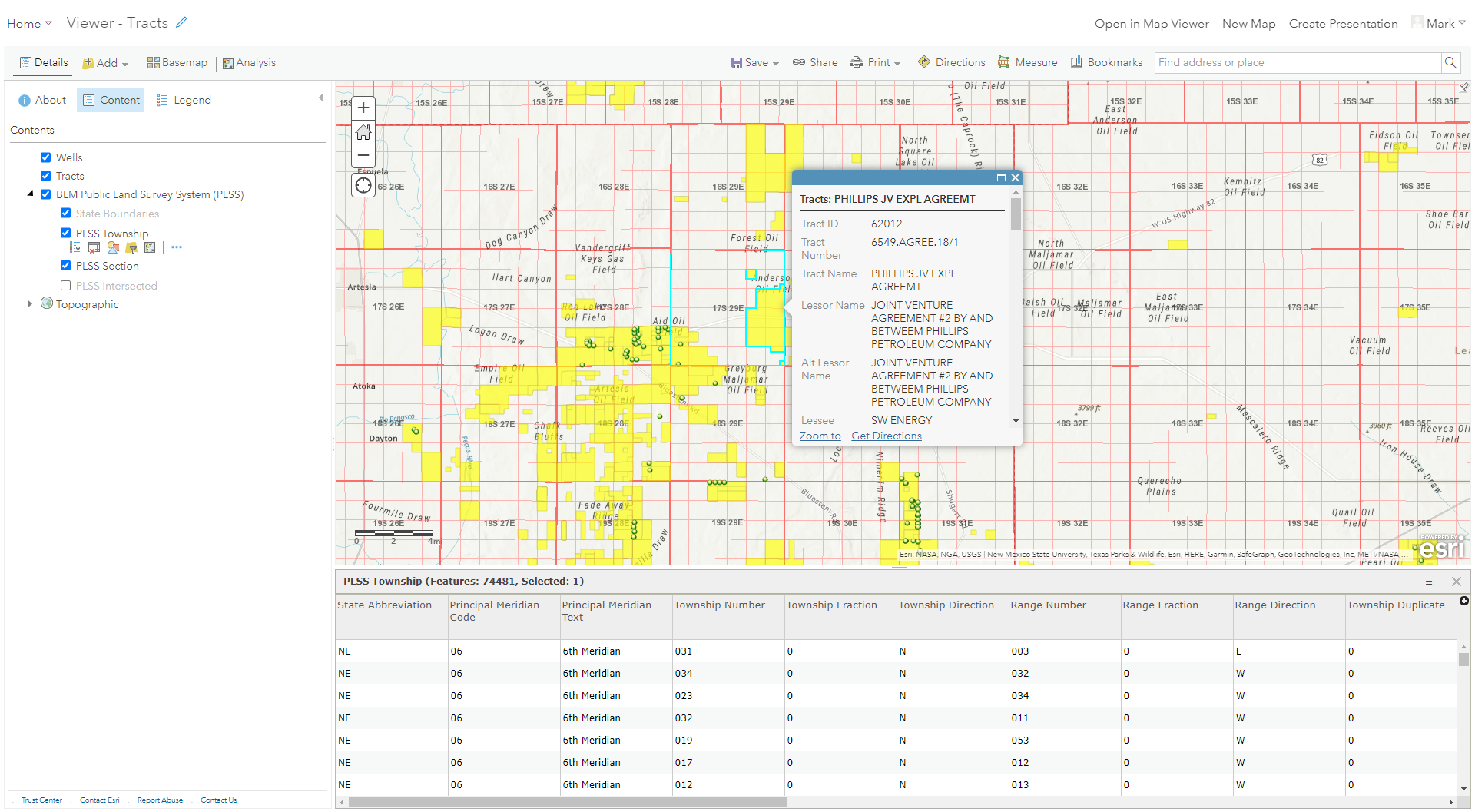
Once all of the service definitions have been added and saved, we have completed creating the web map.
Creating the Web Application
The web map is the basic platform that holds the published layers. The web app is a separate application that comes with pre-built templates that offers a variety of tools for end users to leverage.
The web app is meant to complement the web map and is what clients interact with.
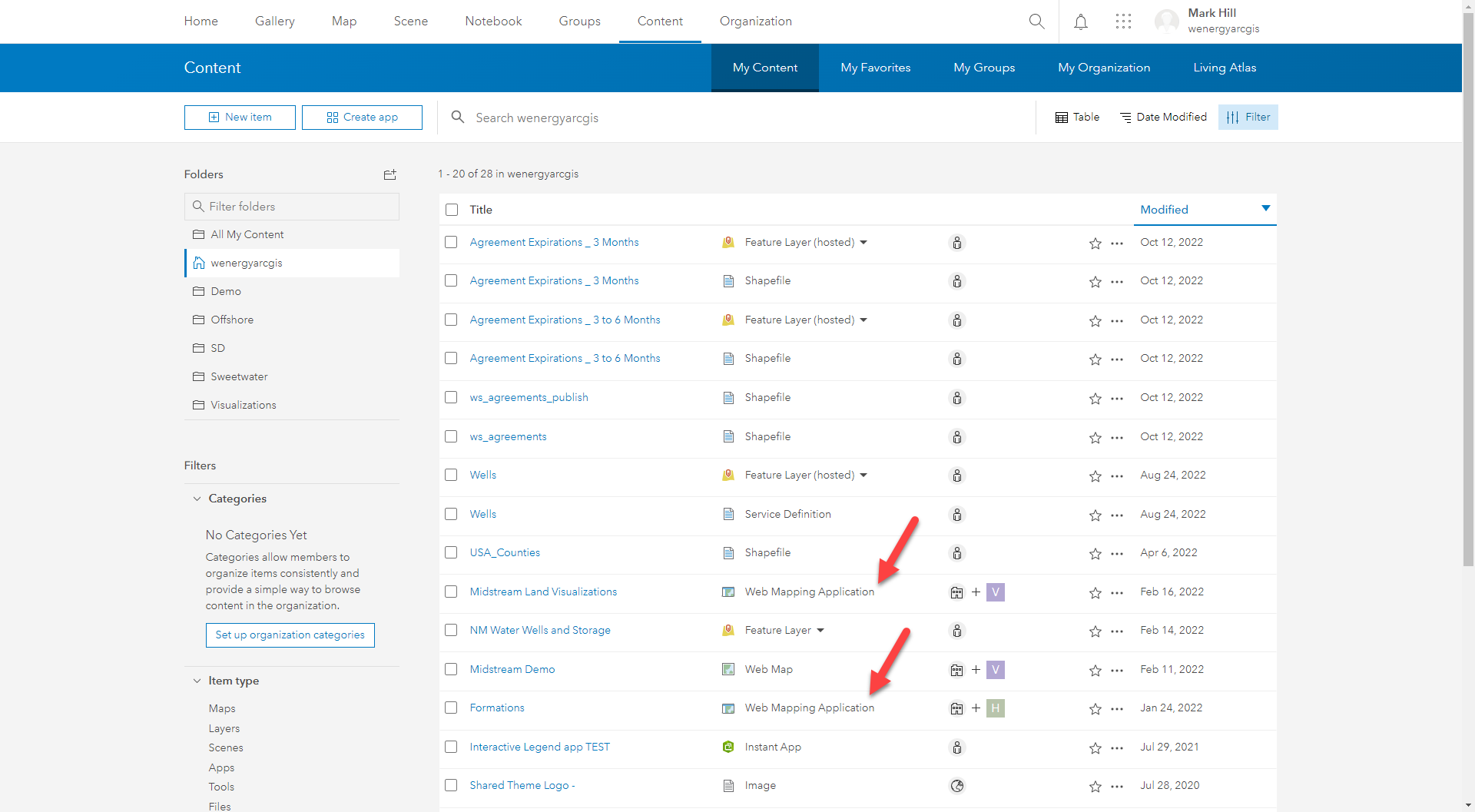
Please talk to Jeremy Larsen on the web application creation. Example web applications can be found under Content / My Content.
How does this concept impact/feed other areas in the application?
The web applications are great for client departments outside of the GIS realm. The apps provide insight into what the client owns, future prospects, and more in a spatial manner to add context to the Land data.
Other items worth noting that would impact the process.
Changes coming soon
WEMAIN-1535
Known issues with the process
Frequently Asked Client Questions
Links provided are from W Energy Software Support Confluence Space @a user