
Upload the Land Legal Descriptions 📜
What are Land Legal Descriptions?
A Land Legal Description is a location to describe and uniquely identify a piece of real property. They are loaded underneath Tracts to describe where the property exists.
Example: NW/4 Section 23 Township 11N in Lea County, New Mexico
Who benefits from the use of Land Legal Descriptions (if users would benefit or customers of users)
Both Land and GIS Analysts benefit from Land Legal Descriptions.
The Land Legal Description inputs from the Land Analyst allow for the GIS Automapper to find that unique location on the grid data, copy the geometry of the polygon from the grid data, and output the polygon to map the Land Legal Description.
They can also be used by GIS Analysts to manually map the polygons, depending on the company’s workflow (i.e. when the GIS Analyst isn’t provided separate documents for this purpose).
How to Manually Enter a Land Legal Item into the System
To add a Land Legal Item, navigate to Land Agreements / Tracts in the main application.
Click into an Active Tract.
Toggle over to the Legal Description tab.
Click Add Jeffersonian Item, Add Non-Jeffersonian Item, or Add Offshore Item.
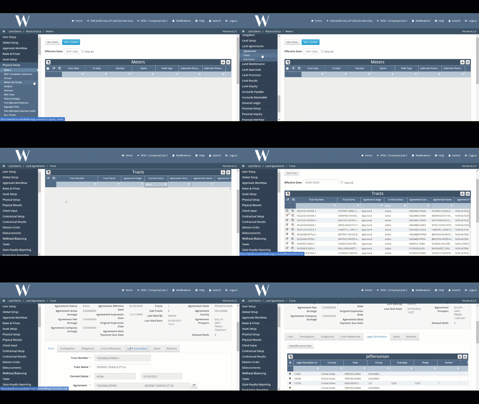
Fill out the necessary dropdowns. In addition to the Legal Acreage field, below are the minimum fields required for each area to be automapped in GIS.
Jeffersonian: Country, State, County, Township, Range, Principal Meridian, Section
Non-Jeffersonian:
Method I: Country, State, County, Abstract
Method II: Country, State, County, Survey, Block, Section
Method III: Country, State, County, Tax Parcel
Offshore: Country, State, County, Area, Block
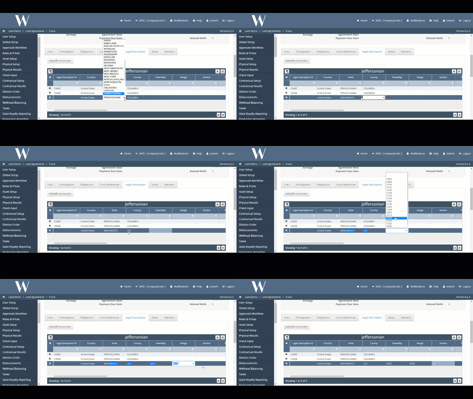
Note: A Land Legal Item is the entire row/line item entered above which includes the Land Legal Description, map status, legal acreage, etc. The Land Legal Description is only the part that describes the physical location of the land (Ex. Reeves County, TX - Abstract: A-152)
Once you hit the Update button to save the Legal Item, the Legal Description ID auto-generates the next id in the system. This is the unique identifier the Land and GIS Analyst leverage to describe a Land Legal Item. This id is referenced in the database as dbo.legal_items.id.
How to Leverage the Uploader Template to Enter a Land Legal Item into the System
Clients also leverage the import (aka uploader) template as another method to populating the Land Legal Items. This functionality is used to upload the initial data set of Legal Items during the project implementation and post go-live for large data sets.
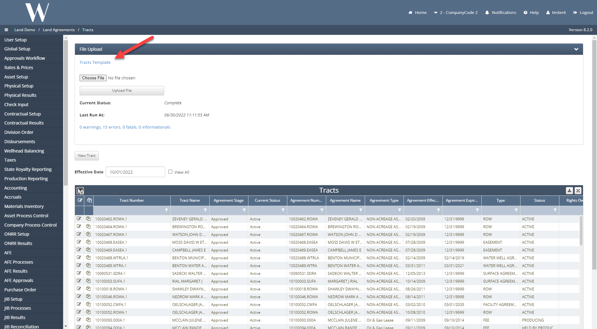
Navigate to Land Agreements / Tracts. The Tracts Uploader Template can be downloaded here.
Only the Header tab and the respective area tab where the Legal Item exists are required to be populated (Ex. Jeffersonian, Non-Jeffersonian, Offshore).
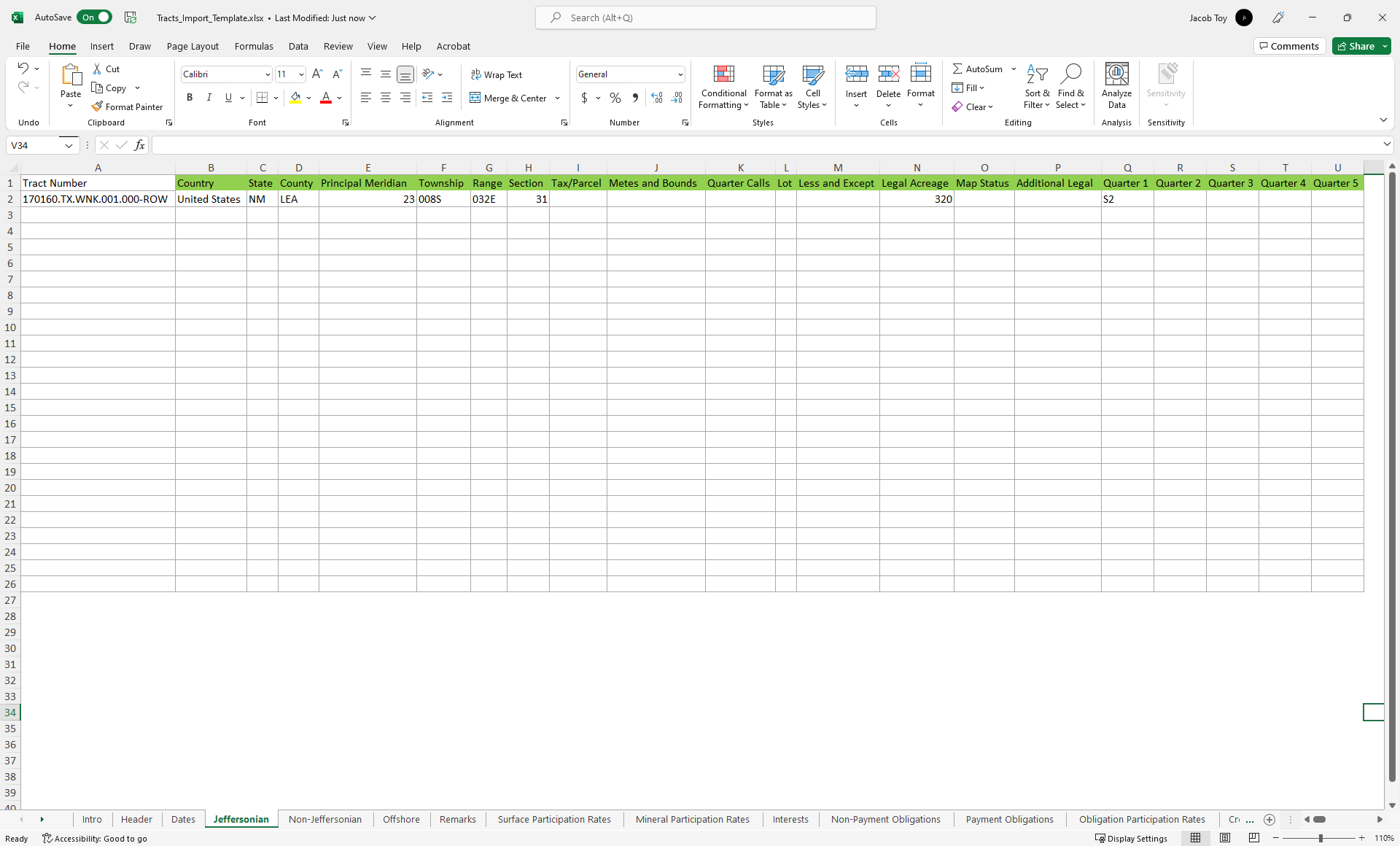
The non-filled column headers are required to be populated and the green-filled headers are optional.
Once the template has been populated, the spreadsheet can be uploaded in the Tracts Browse Screen.
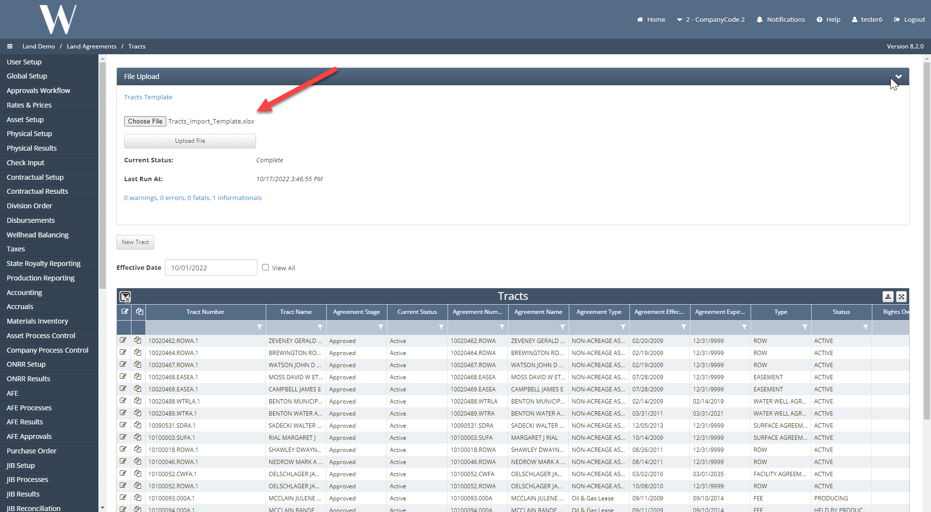
Any errors with the upload will forfeit the entire job and none of the records on the template will have been entered into the database. Feedback on the errors and how to resolve them appear in a hyperlink under the Upload File button.
The Legal Item has now been populated into the system.
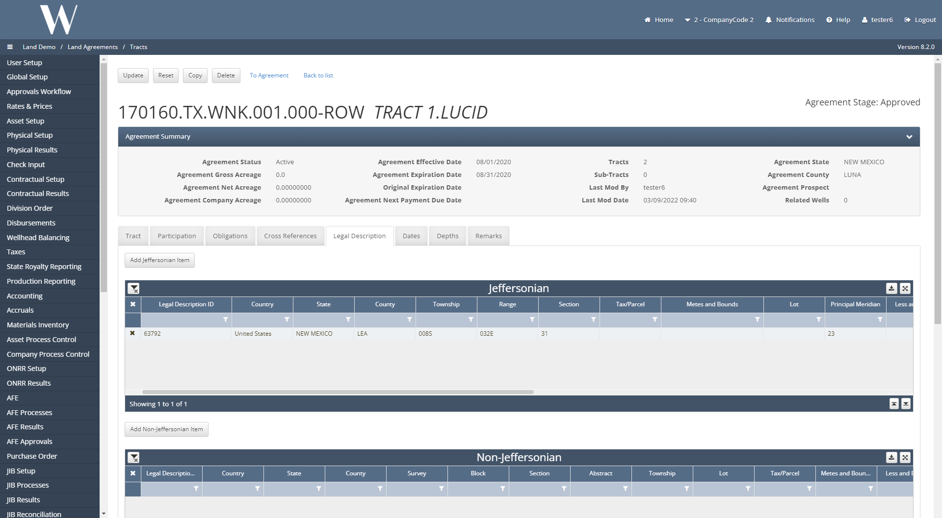
Below are the pre-requisites for the Land Legal Item to be automapped in the GIS module:
Map Status Field: Not Mapped, Needs Review, Blank, or NULL
Legal Description is fully populated
Metes & Bounds Field is not populated
Other items worth noting that would impact the process.
Changes coming soon
WEMAIN-4389
WEMAIN-5453
Known issues with the process
WMA-46268
On the Tract Uploader Template, verify if the Less and Except, Metes and Bounds, Additional Legal, and/or Quarter Calls fields have character limits over 255 characters. The uploader template will successfully upload but will chop off end of any fields over 255 characters without warning.