
Spatial Report Viewer 📝
What is the Spatial Report Viewer?
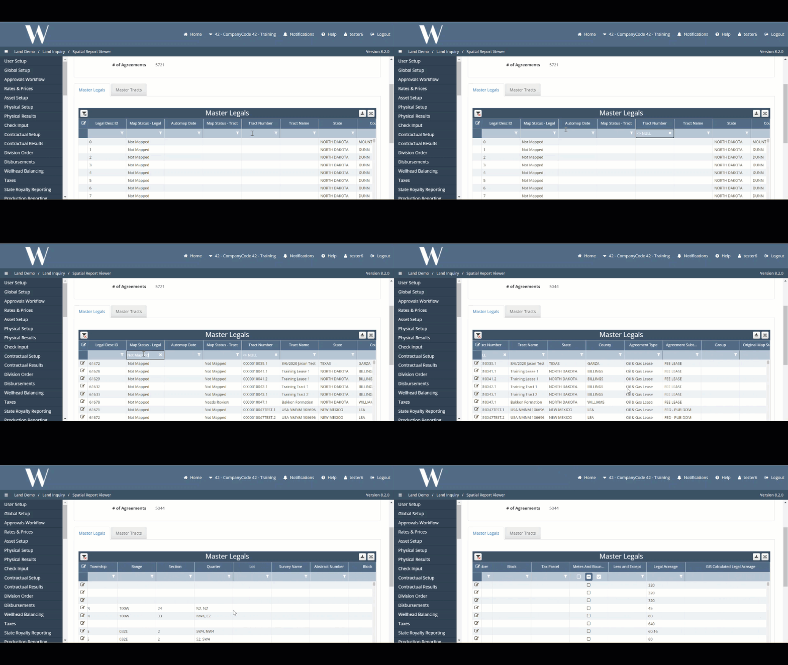
The Spatial Report Viewer (SRV) is a read-only screen that houses all of the legal items and tracts under a single roof.
Why would a client use the Spatial Report Viewer?
The tool combines attributes from the Land module with the output from the GIS module to provide insight to both the Land and GIS Analysts on what has been mapped and what remains outstanding.
What Configurations apply when using the Spatial Report Viewer?
This is client and environment specific; please update for each client environment.
gis_sql:
  username: gas_plant
  password: veggie_petroleum
  database: surge_gis_project
  port: 1433
  host: sql3.we.local

gis_host: sql3.we.local
gis_database: surge_gis_project
gis_table_schema: dbo
How to setup Spatial Report Viewer in the system
The SRV is only configured and available if the client takes both Land and GIS. This is set up by DevOps, and an example ticket as provided below:
WEDEVOPS-4256
How does this concept impact/feed other areas in the application?
The SRV combines Land and GIS data to provide intel on what has been successfully mapped and what has not at both the legal item and tract levels.
For Land data, the SRV includes but is not limited to: legal_description_id, tract_id, agreement_id, legal description, tract status, legal acreage
For GIS data, the SRV displays: legal map status, tract map status, calculated GIS acreage
Alternative Method
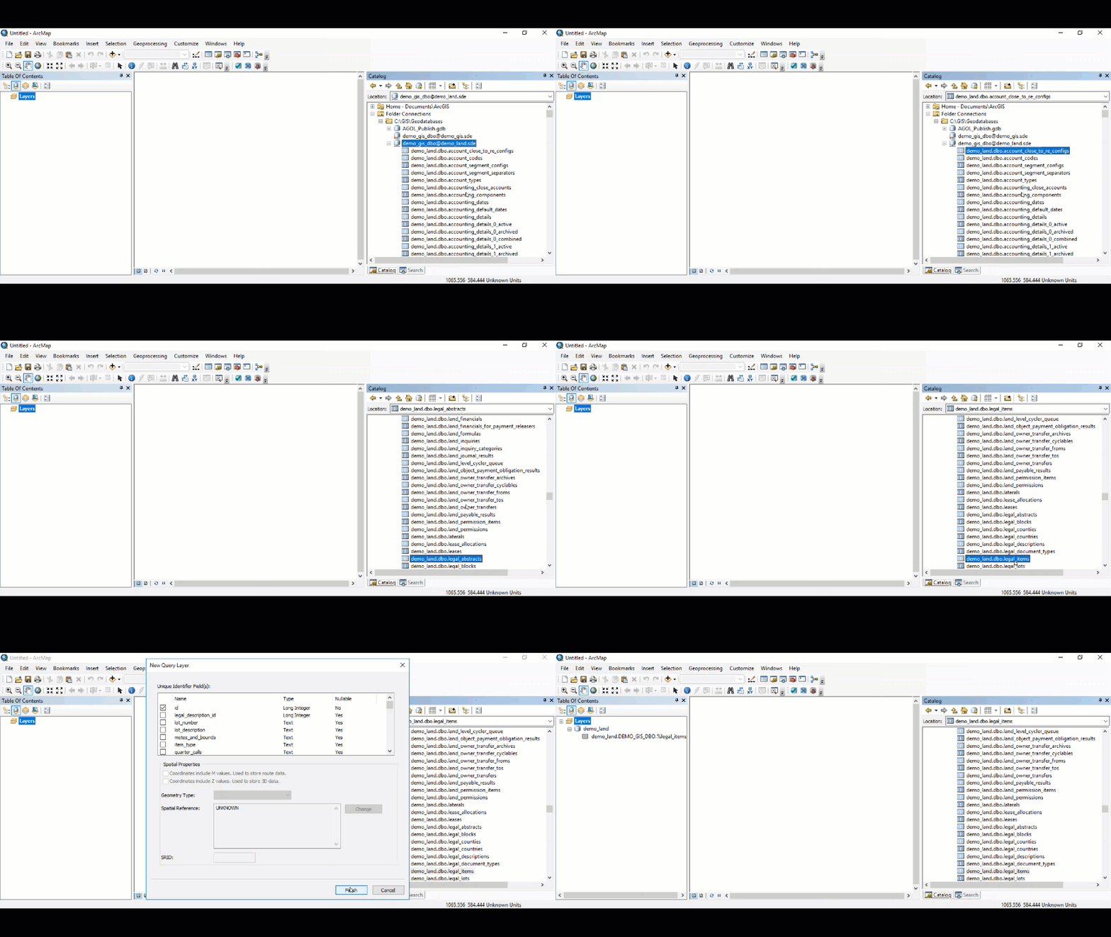
An alternative method to leveraging the SRV is to use the database connection in ArcGIS Desktop. This is a less user friendly interface but still a powerful tool for the GIS Analyst (only GIS Analyst(s) have access to ArcGIS Desktop).
Launch the VDI with ArcGIS Desktop.
Drag and drop the legal_items table from the main database connection to the Table of Contents.
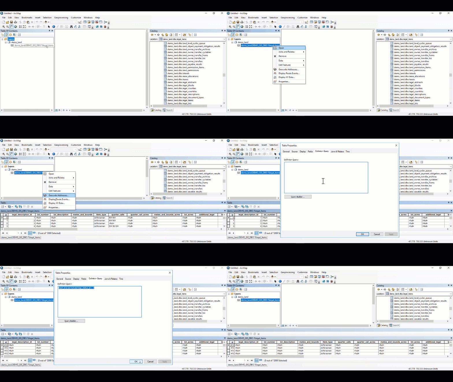
In the Table of Contents, right-click on the legal_items table, select Open which opens the textual attributes.
Right-click once more and select Properties.
In the Definition Query tab, a definition query can be added to view which legal items have and have not been mapped.
The example query below returns legal items that have a parent tract and have not been mapped: (map_status_id = 2 or map_status_id is NULL) and tract_id is not null
Other modules than Land use the legal_items table, but the rows for these other modules will have null parent tract ids. This is why we need only the legal items where the tract_id is null.
Other items worth noting that would impact the process.
Known issues with the process
WEDEVOPS-7482
WEDEVOPS-7483