
Manually Linking a Polygon 🔗
What is the Link Polygons Tool?
The Link Polygons Tool is a GIS tool that exists in the W Energy Spatial Add-In. This is a proprietary extension that lives on top of ArcGIS Desktop similar to how Google Chrome can host 3rd party vendor extensions such as AdBlock.
This tool links polygons to Land Legal Items and rolls that polygon up to the parent Tract and Agreement.
Why would a client use the Link Polygons Tool?
Some Land Legal Descriptions are too complex for the Automapper to automap, thus they need to be manually drawn and linked. For example, the following Metes & Bounds Description is too difficult for a machine to decipher and accurately map.
Beginning at the SW Corner of the West 1/2 of East 1/2 of NE 1/4 of NW 1/4 of Section 18 Township 2 North, Range 14 East and run S 0 degrees 04’09” W 39 feet to the North right of way line of Silver Lake Road and the Point of Beginning.
As a result, the default configuration does not have the Automapper attempt to automap Land Legal Items where the Metes & Bounds field is populated.
How to setup the Link Polygons Tool in the system
The Link Polygons Tool is not setup by Services but rather by a GIS Developer. The tool is a part of the W Energy Spatial Add-In which is a toolbar that includes the Link Polygons tool. This add-in can be requested in a ticket similar to the one referenced below:
WEMAIN-4882
How to Use the Link Polygons Tool
In ArcMap, expand the Folder Connections tab in the Catalog Pane.
Right-click under one of the folder connections and select New / File Geodatabase.
You can rename the file geodatabase if you wish.
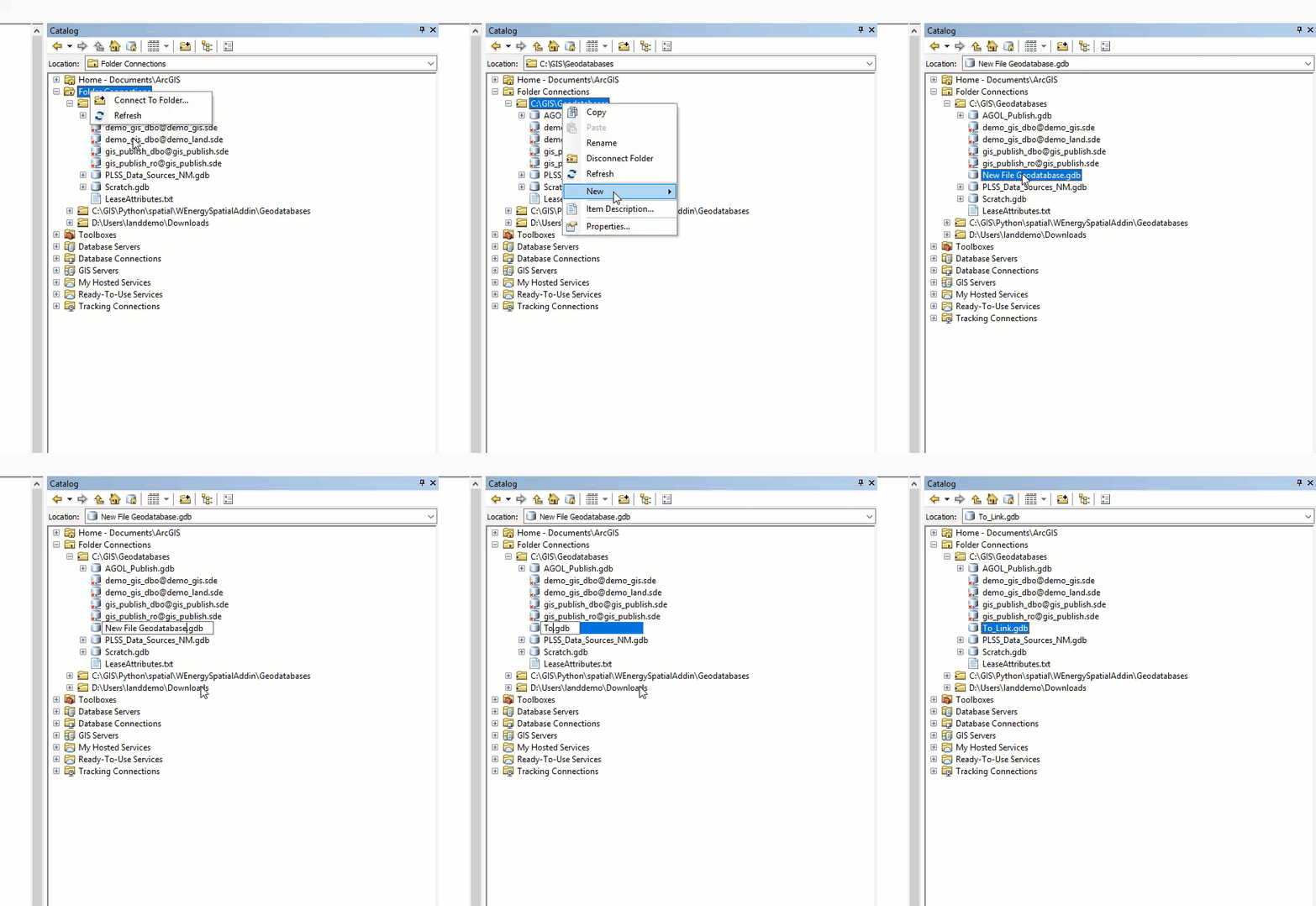
Right-click on the newly created file geodatabase.
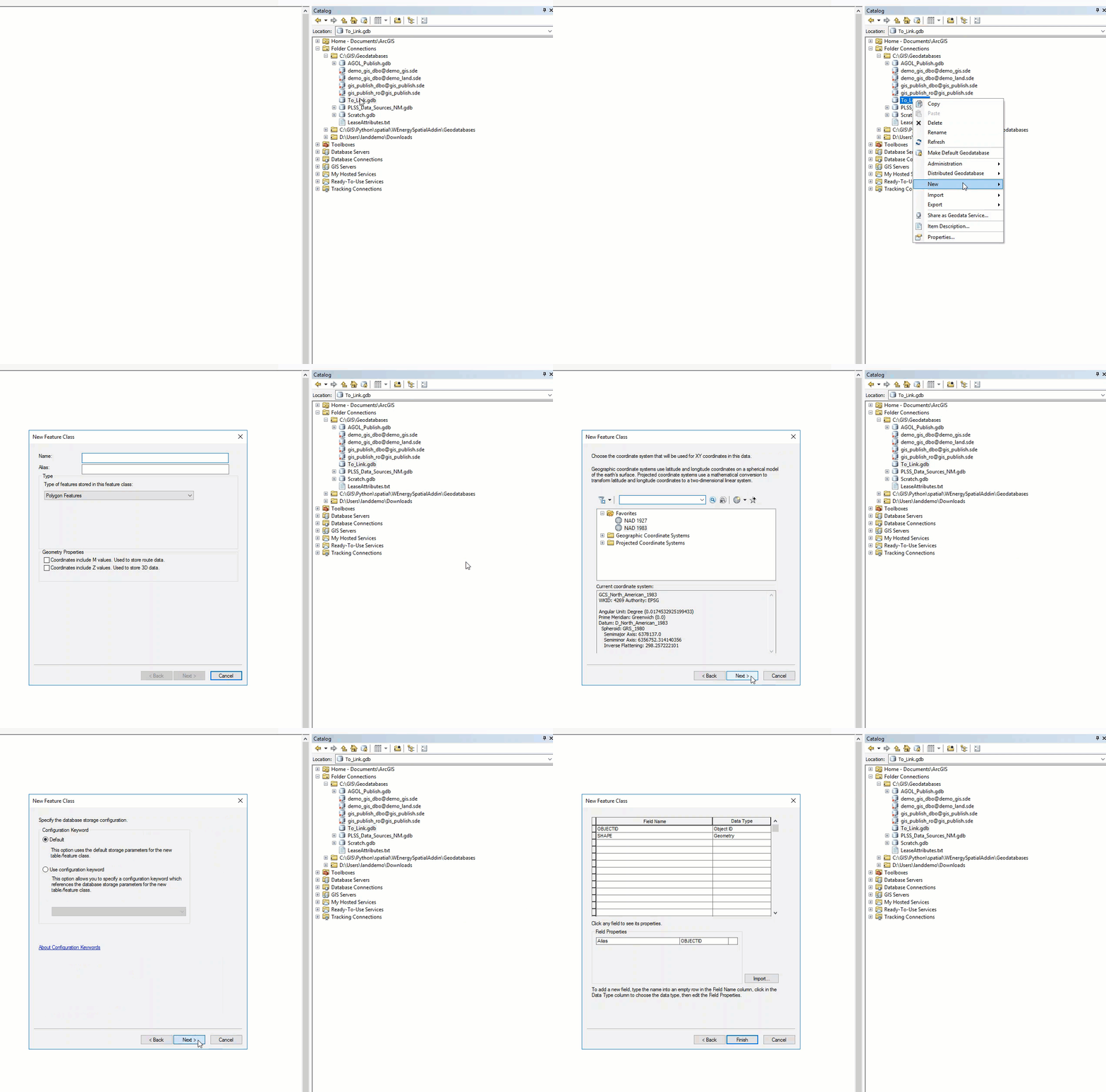
Select New / Feature Class.
In the window, provide the feature class with a name.
This feature class will hold the legal item polygons that we draw and will manually link to legal items.
Care should be taken in making sure that the correct Coordinate System is selected.
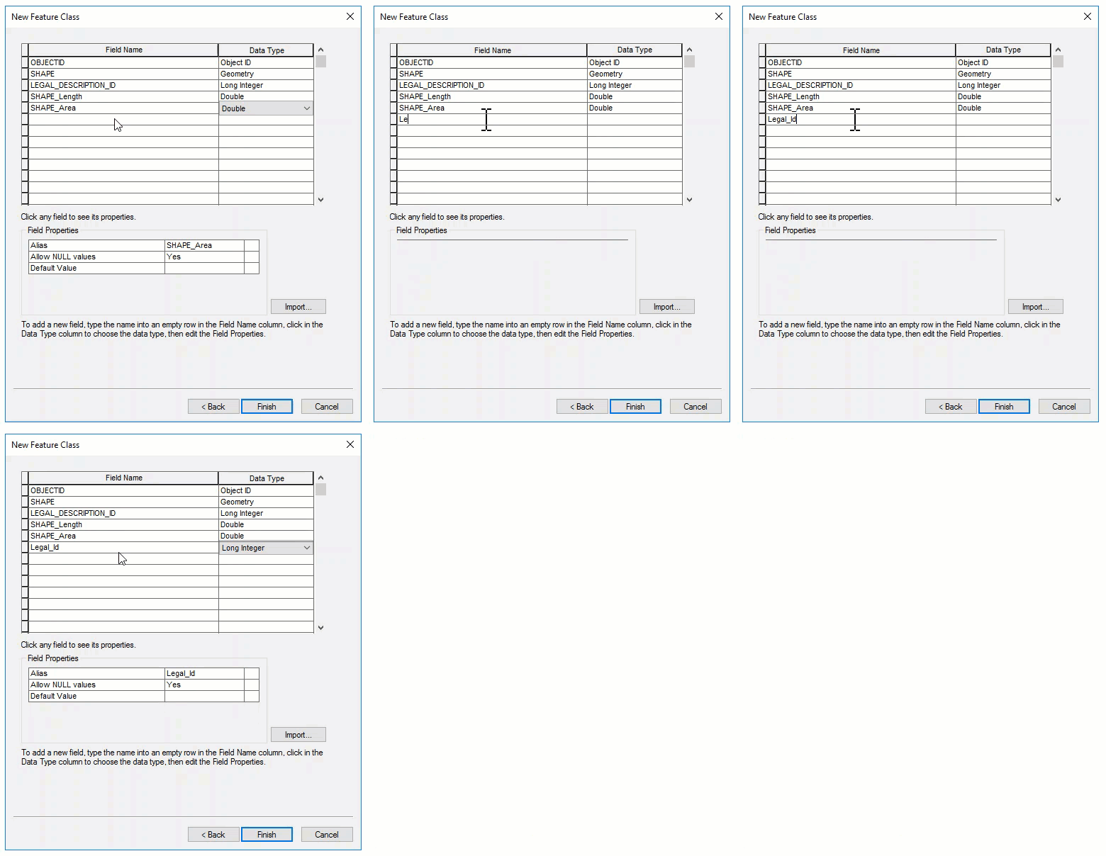
Add the LEGAL_DESCRIPTION_ID field with the corresponding data type to the feature class:

Ensure the LEGAL_DESCRIPTION_ID field is in all caps.
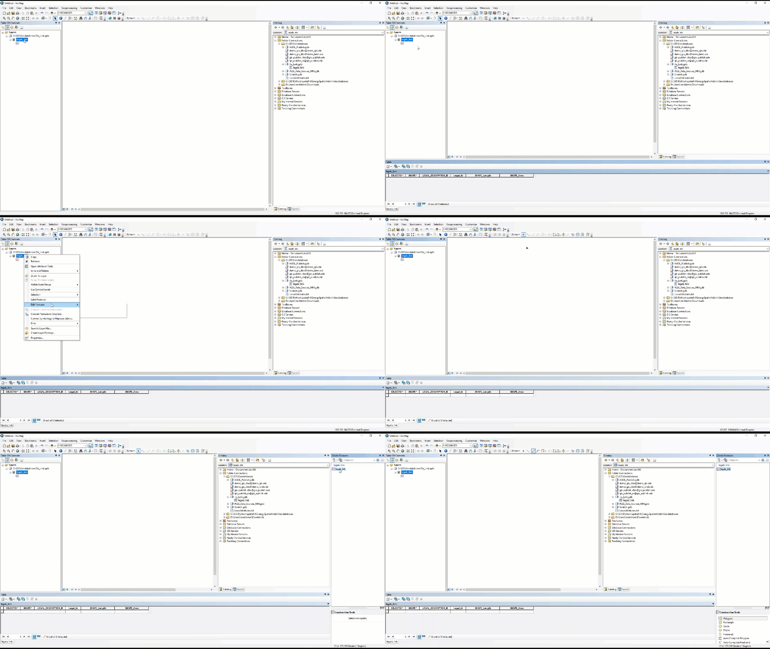
The new feature class should have been added to the dataframe, but if it has not, please add it.
In the Table of Contents, right-click on the feature class.
Select Open Attribute Table.
Right-click on the feature class once more.
Select Edit Features / Start Editing.
In the Editor Toolbar at the top, select the Create Feature icon.
In the Create Features pane, select the feature class followed by a shape in the Construction Tools.
We are ready to draw a polygon.
We will now find which legal items have not been mapped with a Metes & Bounds Description.
In the W main application, navigate to the Land Inquiry / Spatial Report Viewer screen.
Add in the following filters to the following fields:
Map Status - Legal: Not Mapped | NULL(TRUE)
Tract Number - <> NULL
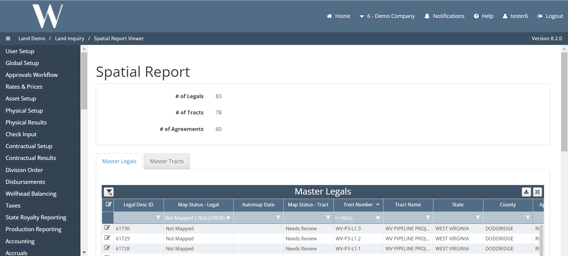
Once the legal item has been selected from the list, copy the id from the legal items table.
This will serve as the identifier for the polygon we will draw.
Drag and drop the grid data that will be used as a stencil to draw the polygon.
Without any reference polygon in the background, I could be drawing a polygon too large to be linked, so I zoomed into a West Virginia tax parcel.
In the Construction Tools, I selected a polygon and drew the shape in the dataframe.
In the Attribute Table of the legals_link feature class, paste the copied id into the LEGAL_DESCRIPTION_ID and Legal_Id fields.
In the Editor Toolbar, select Save Edits followed by Stop Editing.
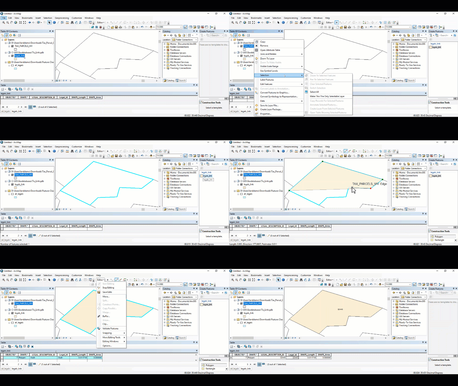
Close the Create Features pane.
Remove the grid data and the legal_items table from the Table of Contents.
In the Table of Contents, right-click on the feature class with the newly drawn polygon.
Select Selection / Make This The Only Selectable Layer.
In the toolbar at the top, select the Select Features tool.
Selecting records from the Attribute Table is an alternative method as well.
In the dataframe, select the polygon that will be manually linked.
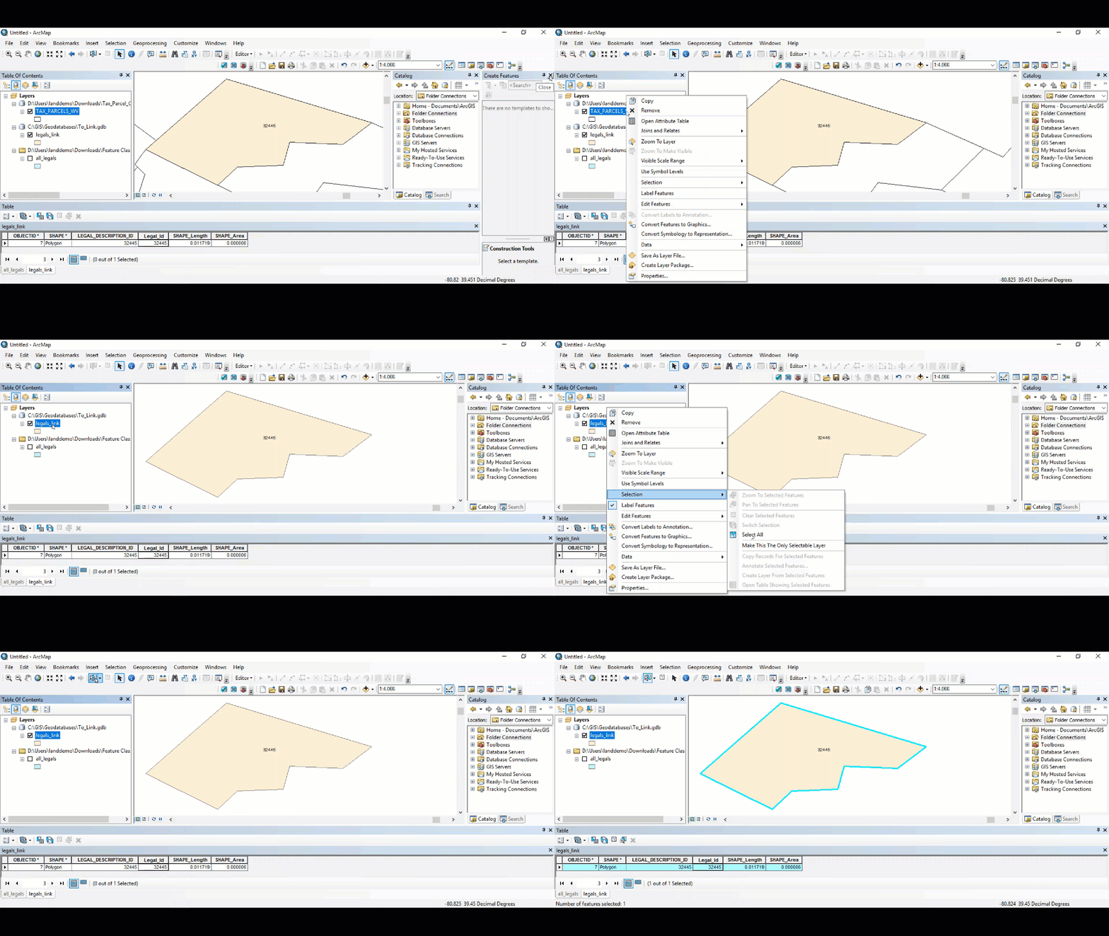
Select the Link Polygons tool in the toolbar.
A window will appear.
In the window, select OK.
The Link Polygons tool will take around 40 seconds base plus some amount of time per polygon.
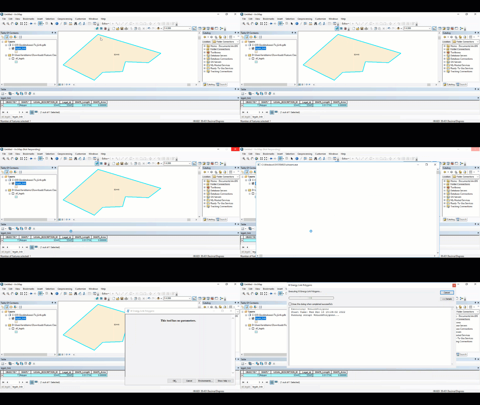
The Link Polygons tool will have completed once the time elapsed appears at the bottom of the results screen.
Please close out of the window.
Drag and drop the all_legals feature class into the dataframe.
Open the Attribute Table of the all_legals layer.
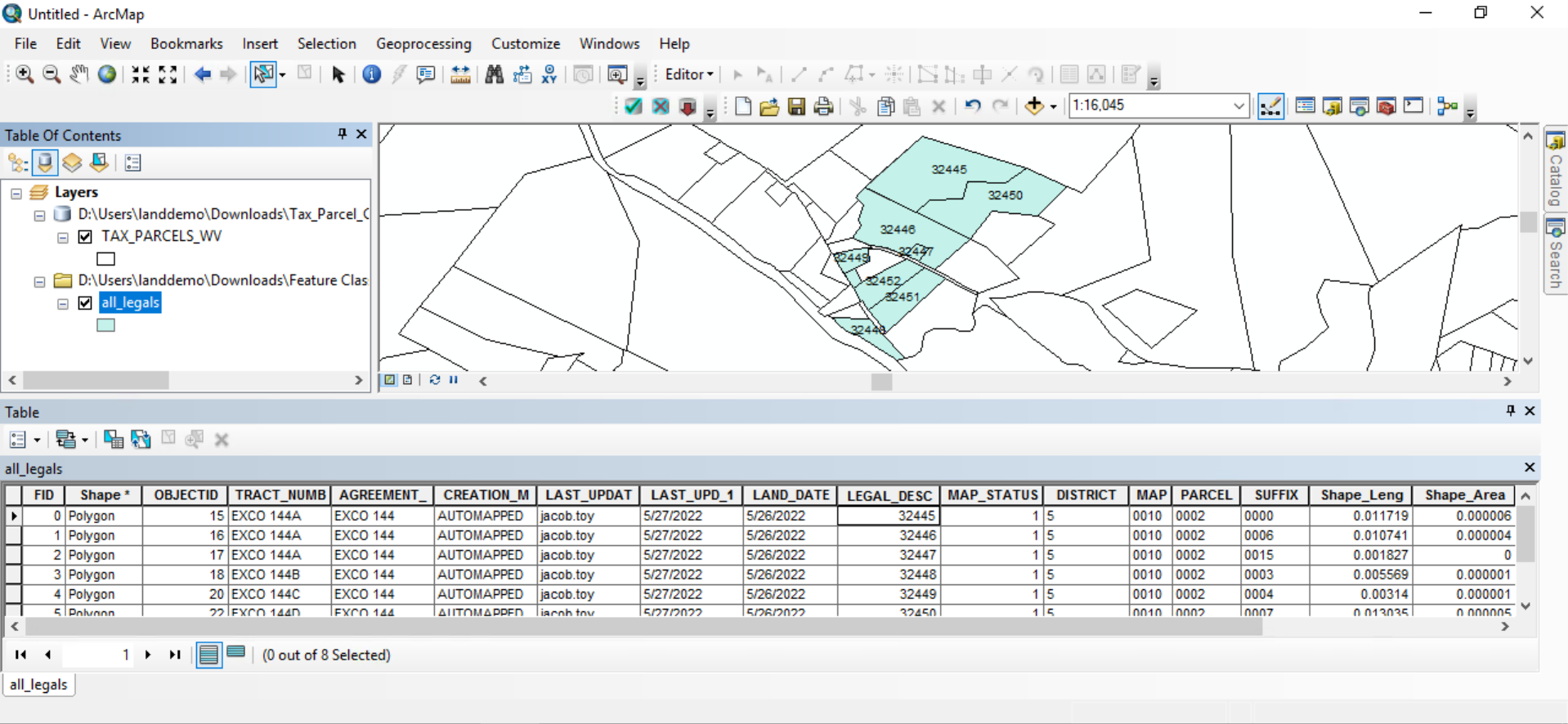
Notice how the manually drawn and linked polygon is included in the layer.
Under the all_legals layer, each legal item has its own polygon.
For the legal items that share the same tract number (Ex. EXCO 144A), these legal item polygons will be dissolved into wherever these legal item polygons share a border.
By dragging and dropping the all_tracts layer into the dataframe, we can see the 3 legal items that all had EXCO 144A as the tract number were dissolved into 1 polygon.
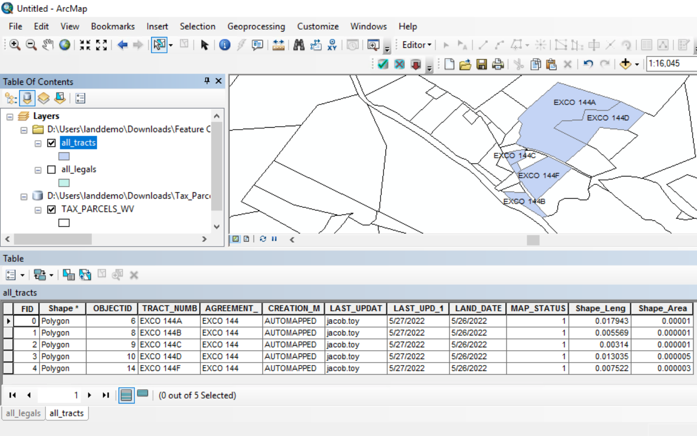
As we can see in the all_tracts layer, all of the tracts share the same agreement number, thus all of the borders that these polygons share will be dissolved once we drag and drop the all_agreements layer into the dataframe.
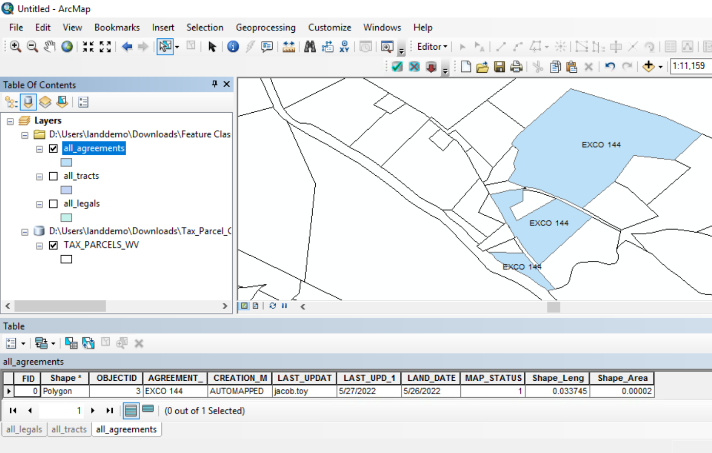
Confirm the legal item polygon was included in the ws_* layers by dragging and dropping those layers into the dataframe.
Other items worth noting that would impact the process.
Known issues with the process
The following are not issues with the process but rather common user errors that can arise.
The Link Polygons Tool may error out if the size of the polygon being linked is too large. If the polygon is the size of Texas, for example, the tool will not link. Standard 640 acre PLSS Sections are better sizes for linking.
If the LEGAL_DESCRIPTION_ID for the polygon that is trying to be linked does not exist in the dbo.legal_items table, then the Link Polygons Tool will error out. The solution is to ensure the LEGAL_DESCRIPTION_ID on the polygon being linked exists in dbo.legal_items.