
Interpreting the dbo.automapper_log Table
What is the dbo.automapper_log?
The automapper_log is a table that is populated after the Automapper has been ran which provides information on which Land Legal Items successfully automapped and which did not.
Why would a client use the automapper_log?
Whether the Automapper was ran as part of a scheduled nightly task or manually, the table can be reviewed to see why certain legal items did not successfully automap.
What Configurations apply when using the automapper_log
To view where the automapper_log resides, open the client_gis_config.yaml file. The file path for the log exists under the AUTOMAP_LOG_TABLE configuration as shown in Figure 1 below:
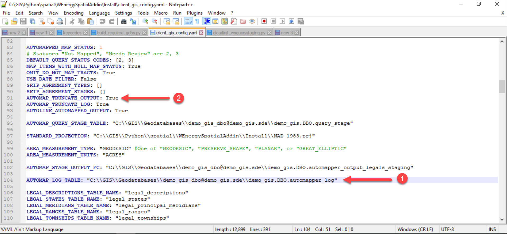
By default, the automapper_log table is truncated from the previous automapping run once the Automapper is ran to create space for the new output.
The AUTOMAP_TRUNCATE_OUTPUT can be set from True to False for truncation to not occur as shown in Figure 2 above. Keep in mind that setting this configuration to False may accumulate to a large automapper_log file over time.
How to Leverage the automapper_log
Drag and drop the automapper_log table into the dataframe.
In the Table of Contents, right-click on the table, and select Open to view the records in the table.
The automapper_log produces an output for each individual item that was pulled into the query_stage table and the Automapper attempted to automap.
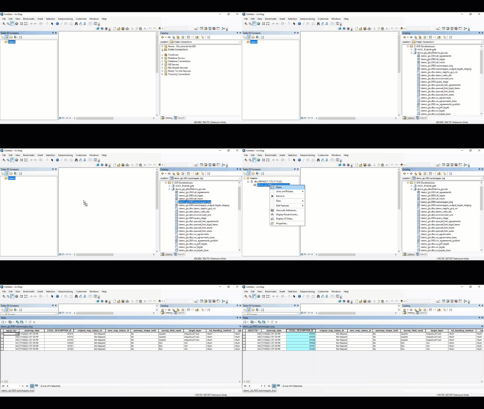
The automapper_log contains several fields including the legal description of the legal item, the automap_process_message, and more.
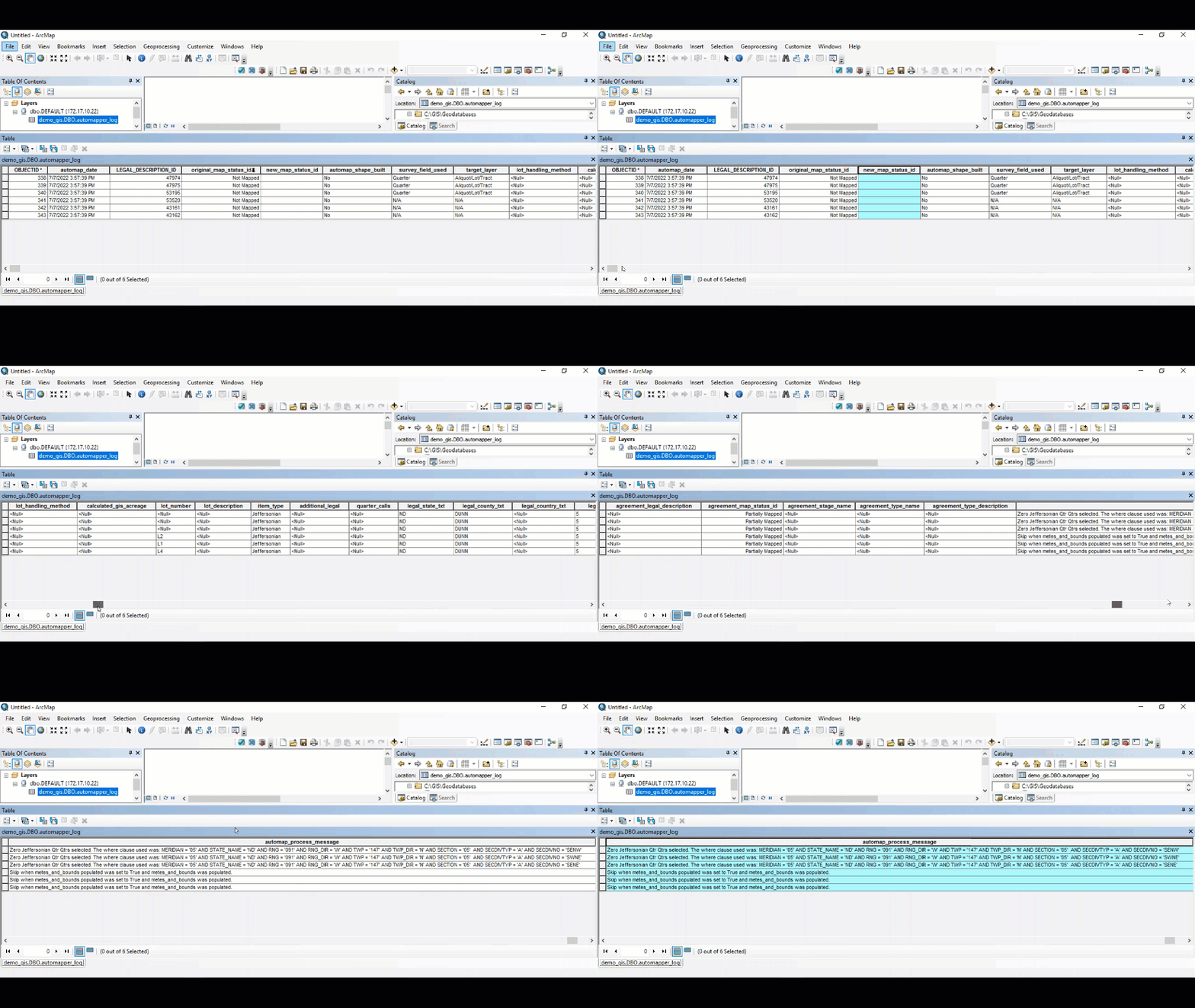
Common Errors the automapper_log Table Produces
Below are common errors that the automapper_log table produces. These are not errors that the Automapper is not working but rather feedback on why the legal item did not successfully automap.
Zero Jeffersonian Qtrs Qtrs selected. The where clause used was [value]:
Error occurs when the legal description with that quarter quarter call combination does not exist on the 2nd division grid.
The legal description may exist on the 1st division grid, but it does not exist on the 2nd division grid with that quarter quarter call combination.
Check the 2nd division grid to see if the referenced Quarter Quarter or Lot exists. It is possible that the plot of land does exist on the 2nd division grid, but exists in the form of a Government Lot rather than quarter quarter calls. If so, the remove the quarter quarter calls from the legal item in the main application and add in the Government Lot value.
Skip when metes_and_bounds populated was set to True and metes_and_bounds was populated.
This is not necessarily an error but rather feedback that the Metes & Bounds field is populated in the main application for this legal item, thus the Automapper intentionally did not automap this legal item.
If it is desired to map this legal item, the GIS Analyst should manually map and link the polygon to the legal item.
Skip when less_and_except populated was set to True and less_and_except was populated.
This is not necessarily an error but rather feedback that the Metes & Bounds field is populated in the main application for this legal item, thus the Automapper intentionally did not automap this legal item.
If it is desired to map this legal item, the GIS Analyst should manually map and link the polygon to the legal item.