
Enabling the Enterprise Geodatabase ✨
What is an Enterprise Geodatabase?
An enterprise geodatabase is a type of database that is accessible in both a database management system (DBMS) such as Microsoft SQL Server and ArcGIS Desktop which is suitable for multi-user edits.
Why would a client use an Enterprise Geodatabase?
A GIS client at W Energy can be supplied with one of two setups:
File Geodatabase Setup
Database objects reside inside a file on the local VDI
Not suitable for multi-user edits since GIS Analysts on other machines cannot access folders on other VDIs
Enterprise Geodatabase Setup
Database objects reside inside a database accessible through a DBMS
Suitable for multi-user edits since GIS Analysts can access database objects that other analysts have been working on so long as both analysts can access the database
How to know if a Database is an Enterprise Geodatabase?
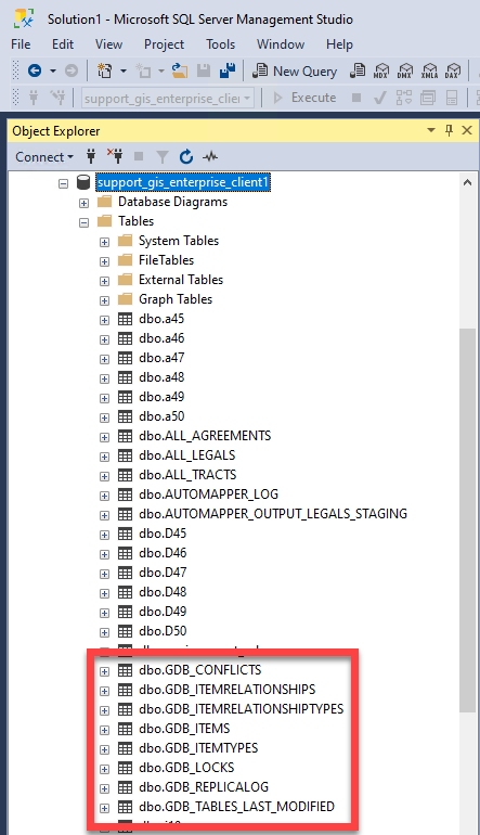
One way to know if a database is a regular database or an enterprise geodatabase is by looking to see if the dbo.GDB_ tables exist in the database. In this scenario, this database does have these tables, thus the enterprise geodatabase functionality has been enabled.
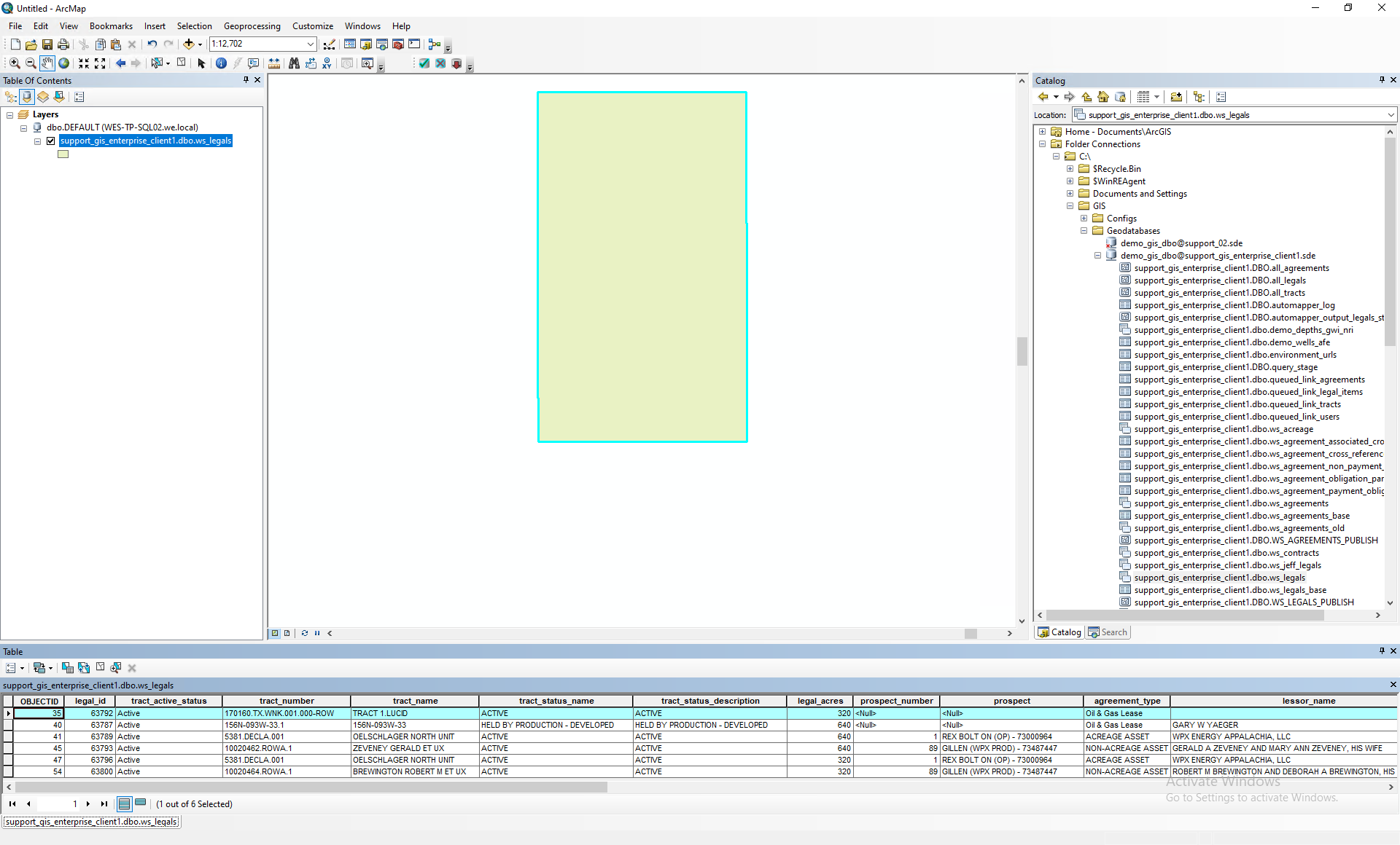
A way to determine if an existing client is an enterprise geodatabase or file geodatabase client is to see where their polygons reside. In the example below, the feature classes under C:\GIS\Geodatabases\demo_gis_dbo@support_gis_enterprise_client1.sde\ws_legals do contain polygons thus this client is an enterprise geodatabase client.
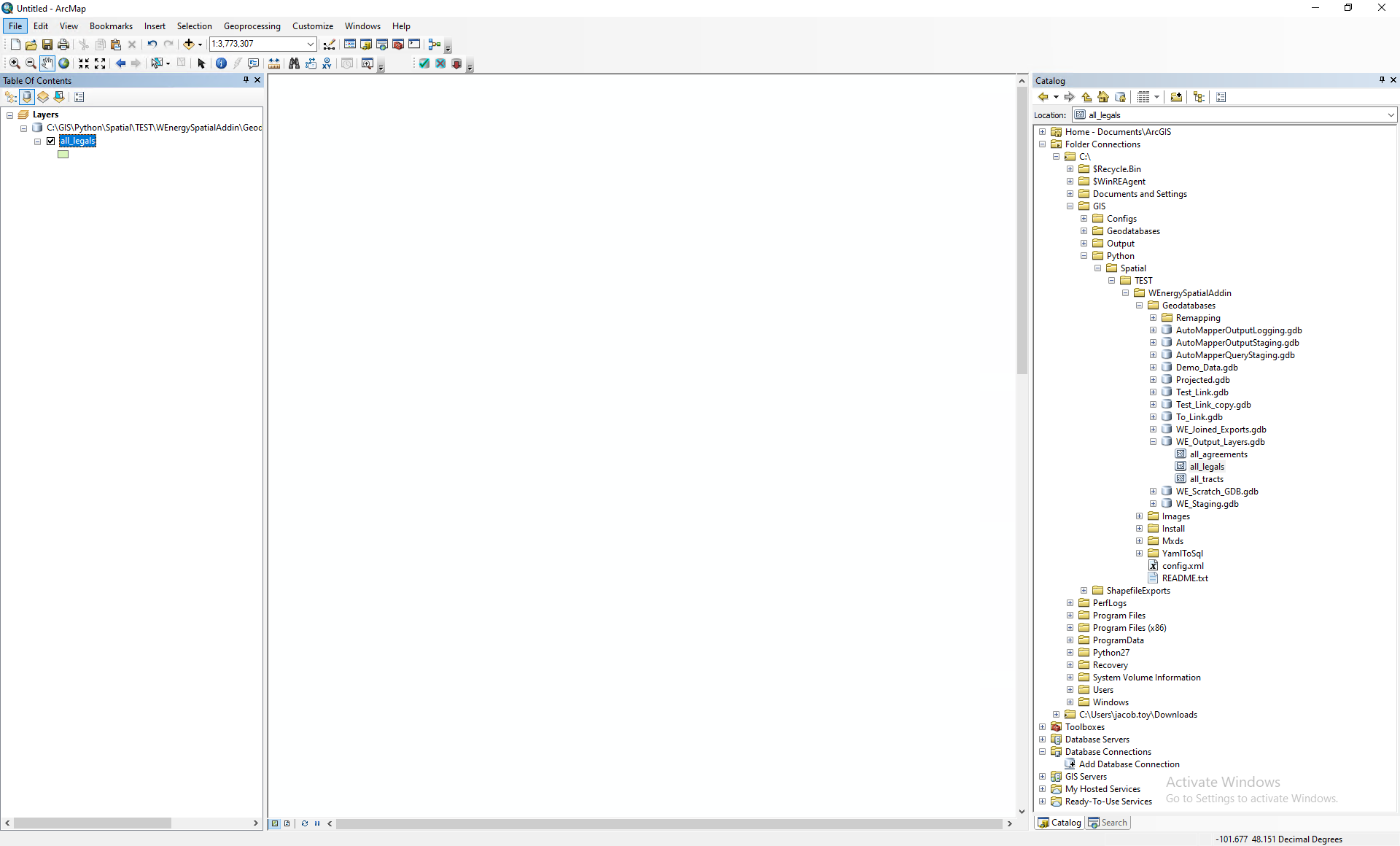
If the polygons exist outside of the database and exist under C:\GIS\Python\Spatial|WEnergySpatialAddin\Geodatabases\WE_Output_Layers.gdb, then this is a file geodatabase client since the polygons exist in a file geodatabase.
How to setup an Enterprise Geodatabase?
Generating a Keycodes File
The keycodes file is the file that is used to enable the enterprise geodatabase. It is a file without an extension (Ex) .txt, .docx, .csv) that can be found in the following file path on the machine that has ArcGIS Desktop: C:\Program Files\ESRI\License10.8\sysgen\keycodes
If the keycodes file cannot be found at that location, it can be generated through My Esri.
Navigate to My Esri using the following link: https://www.esri.com/en-us/my-esri-login
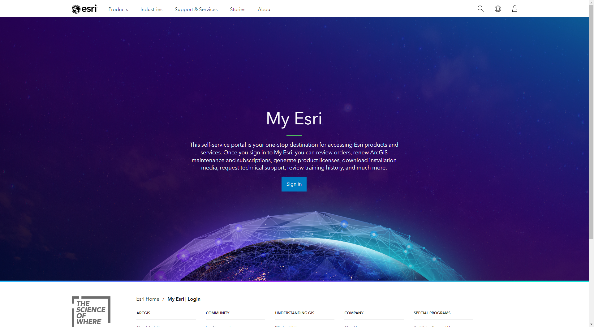
Authenticate into the website.
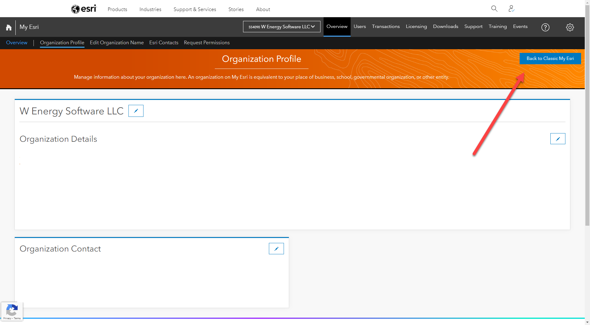
Click on Back to Classic My Esri.
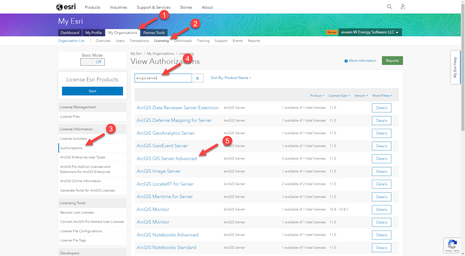
Navigate to My Organizations / Licensing / Authorizations.
In the search bar, type in ArcGIS Server.
Click on ArcGIS GIS Server Advanced.
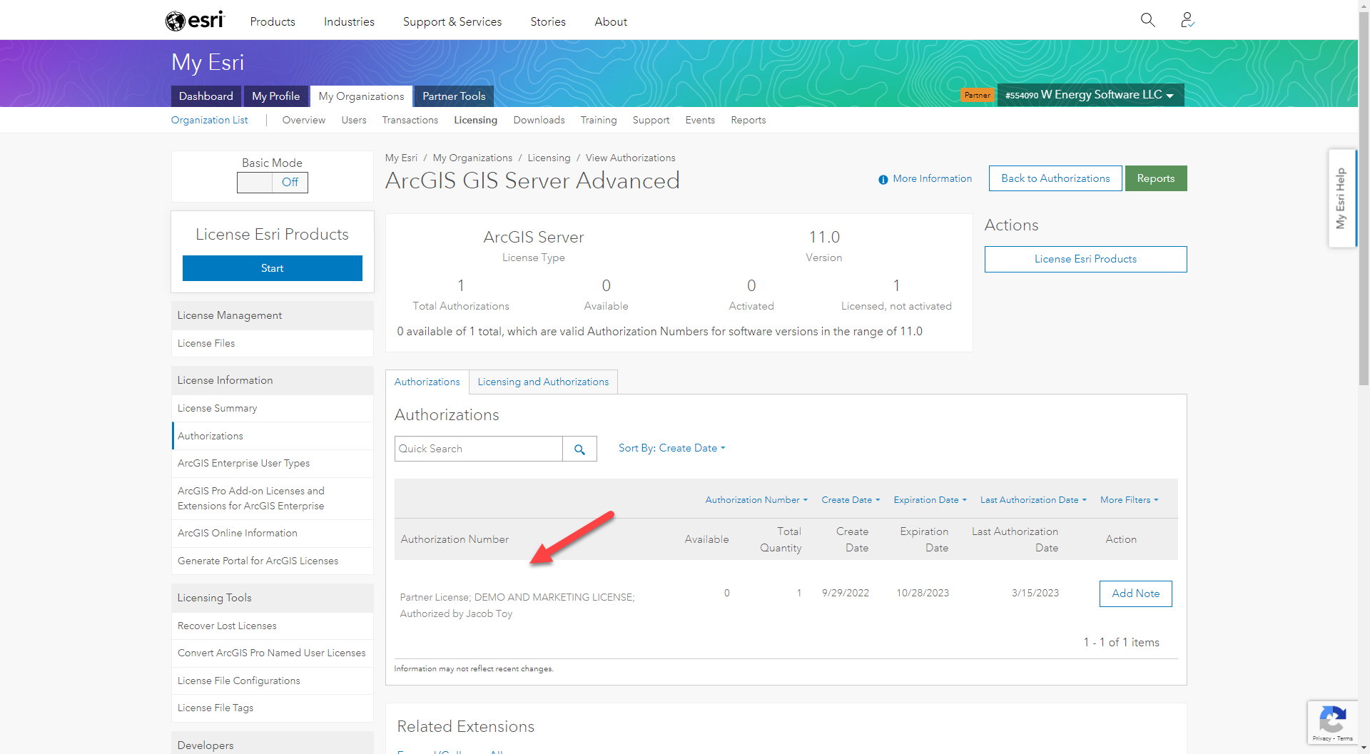
Copy the authorization number which typically starts with “ECP“.
Launch ArcGIS Administrator which is a program on the machine where ArcGIS Desktop is installed.
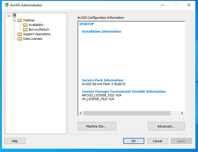
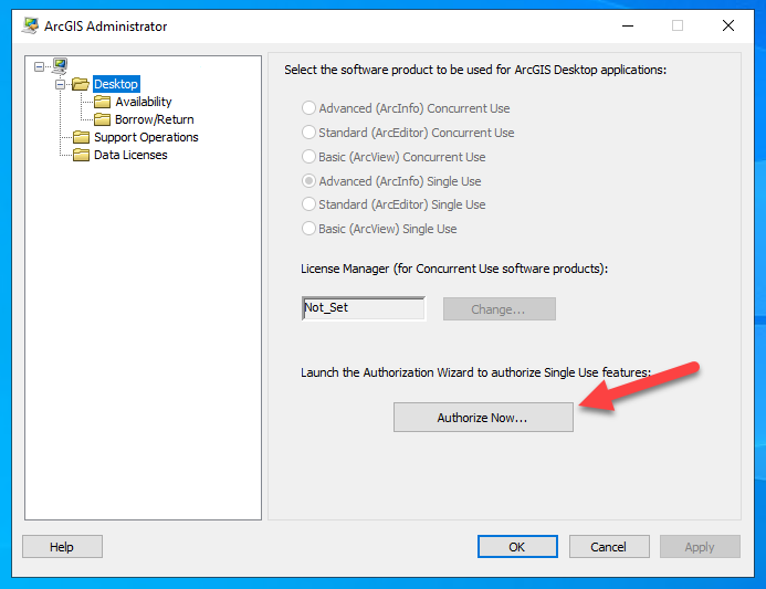
Navigate to the Desktop folder and select Authorize Now…
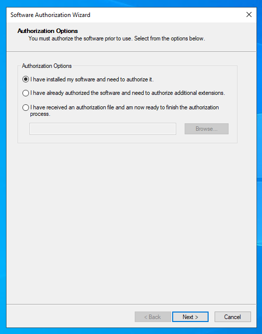
Select the first option below which says “I have installed my software and need to authorize it.“
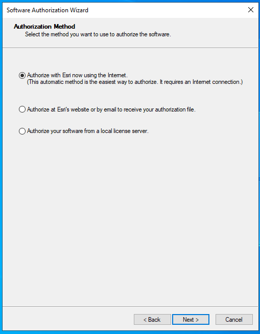
Select the first option below which says “Authorize with Esri now using the Internet. (This automatic method is the easiest way to authorize. It requires an Internet connection.)“.
Paste the copied authorization number here.
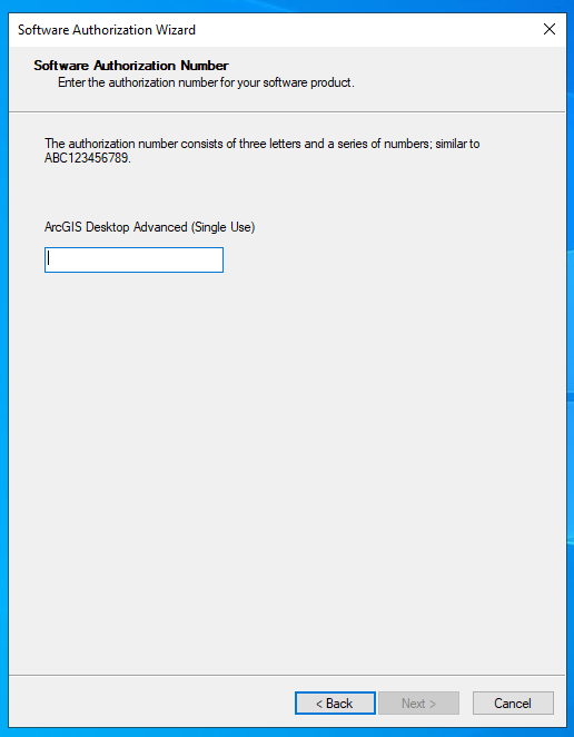
The keycodes file should have been generated. To verify, navigate to C:/Program Files/ESRI/License10.8/sysgen.
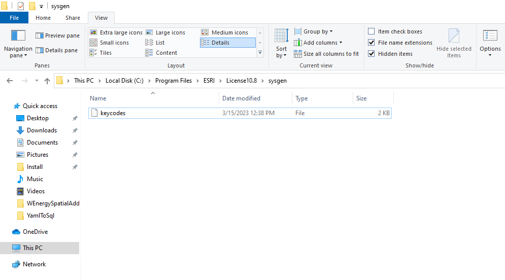
Now that the keycodes file has been generated, we can apply it to the database to enable the enterprise geodatabase functionality.
Launch ArcMap.
Navigate to the database connection you wish to enable with enterprise geodatabase functionality.
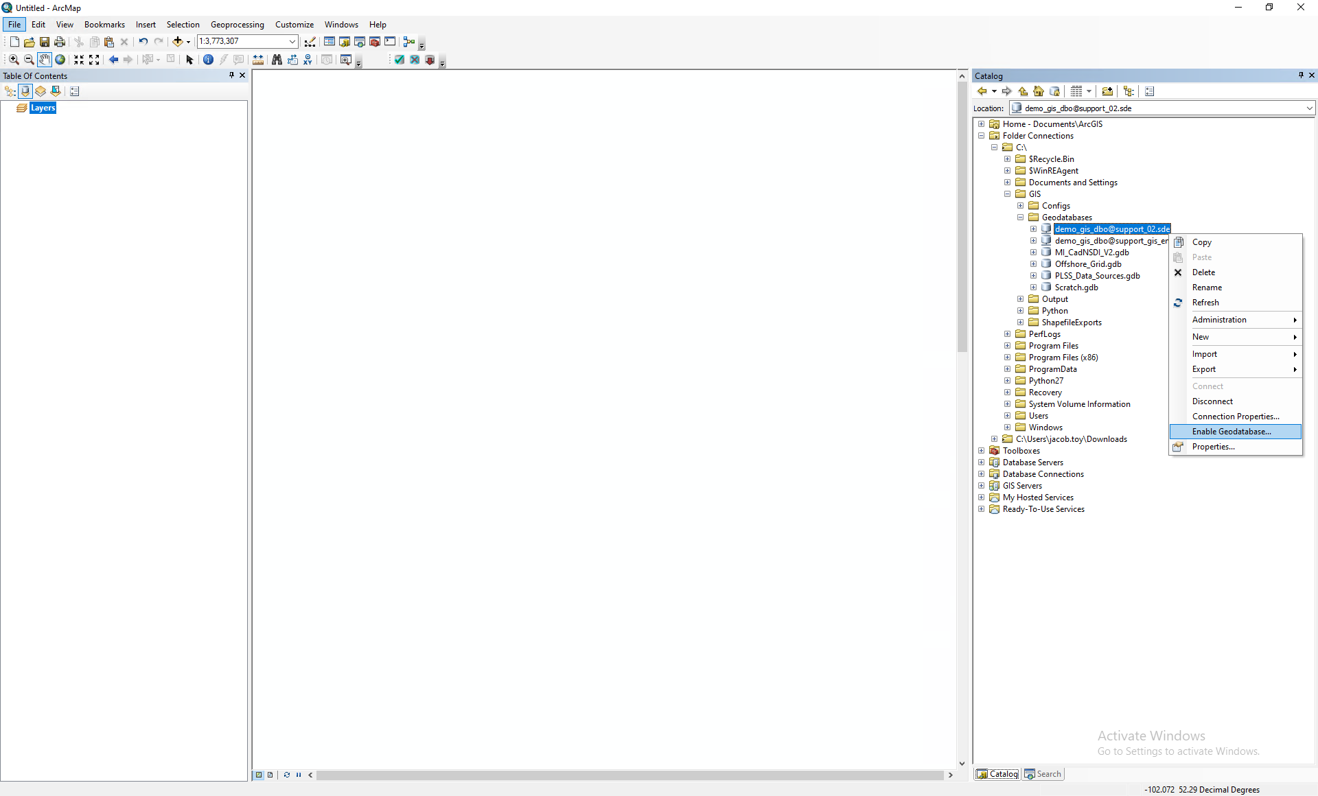
Right-click on the database connection and select Enable Geodatabase…
Note: if that option is unavailable for a database, then the functionality has already been enabled.
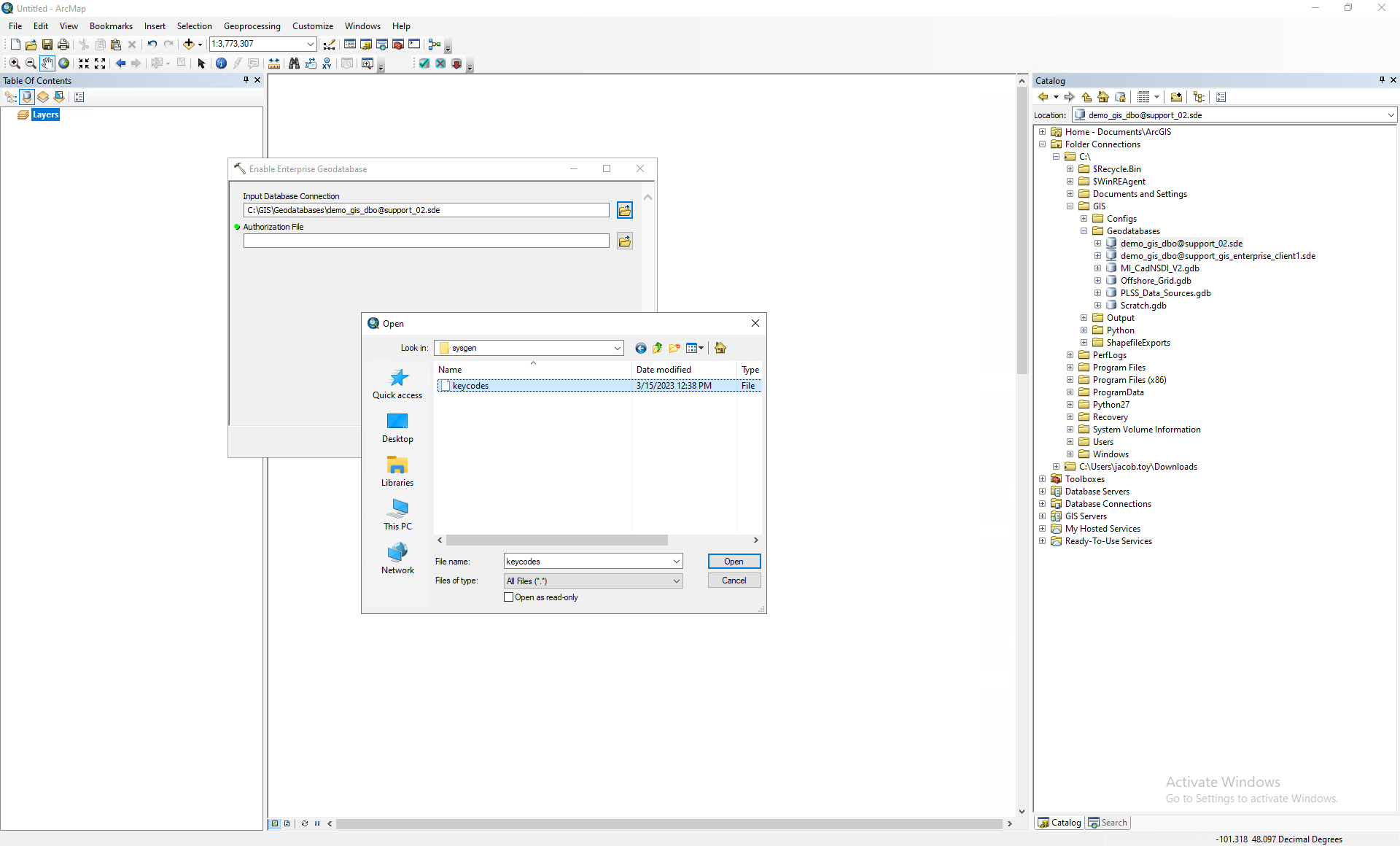
The Input Database Connection should already be populated with the database connection and file path.
The Authorization File is the keycodes file that we generated earlier. Please select that.
The enterprise geodatabase has now been enabled.
The keycodes file can be used multiple times to enable multiple enterprise geodatabases so long as all of the databases belong to the same company/organization.